

Photo by iiievgeniy/Getty Images

Audio By Carbonatix
It might finally be time to swap your trusty rain boots for a pair of, erm, lighter footwear.
South Florida has officially bid farewell to its notoriously soggy rainy season, which typically runs from May 15 to October 15 each year.
Defined as the time of year when 60 to 70 percent of the average yearly rainfall occurs, the season is characterized by consistently high moisture levels, high temperatures, and near-daily development of showers and thunderstorms, according to the National Weather Service (NWS).
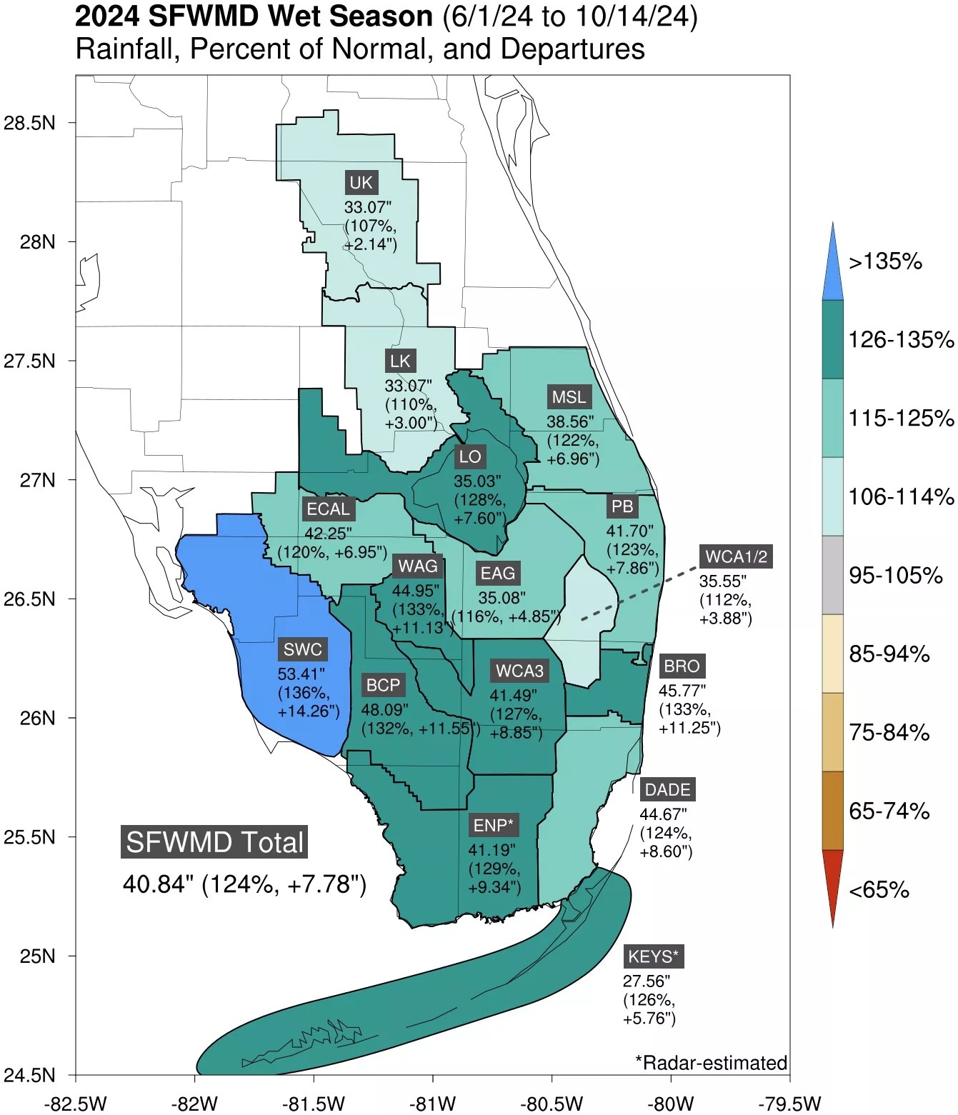
Data from the South Florida Water Management District shows that it was a soggy season for the region.
NWS data indicate that South Florida typically receives 30 to 45 inches of rainfall during its wet season.
Data from the South Florida Water Management District shows that this was in fact a wet one for the region, with Miami-Dade averaging 44.67 inches of rain, Broward County averaging 45.77 inches, and Palm Beach County averaging 41.70 inches of rainfall from June 1 through October 14.
New Times‘ go-to meteorologist Brian McNoldy explains that nature doesn’t always follow the calendar – i.e., there’s no telling whether South Florida’s wet season will end “on time” this year – but one thing is certain: Better weather is ahead.
Speaking of which, South Florida will see a cold front arrive as early as tonight.
“Winds will become northerly by early tomorrow morning and highs will gradually decrease this week,” McNoldy imparts. “Maybe a high of 80 [degrees Fahrenheit] by Friday?”
But don’t dust off your Uggs quite yet. While most of North and Central Florida will see temperatures dip into the 50s and 60s, the apparent temperatures in Miami-Dade and Broward (AKA what the temperatures feel like to human skin – what the northerners call “wind chill”) won’t fall past the low 70s.
It’s surely a start, though.