

Photo by Daniel Grill/Getty Images

Audio By Carbonatix
Keep Miami New Times Free
We’re aiming to raise $7,500 by April 26. Your support ensures Miami New Times can continue watching out for you and our community. No paywall. Always accessible. Daily online and weekly in print.
Heads up, South Florida residents: There’s plenty of weather action to keep an eye on over the next week.
Hurricane Kirk, a Category 4 storm, is churning in the middle of the Atlantic Ocean. While it will eventually veer off toward the European coast, we can expect elevated tides and a risk of coastal flooding along the East Coast by Sunday.
As our trusted Miami weather watcher Brian McNoldy points out on his tropical Atlantic update blog, “The wave field from Kirk will spread throughout the Atlantic, reaching the U.S. east coast on Sunday, resulting in elevated high tides and increased risks of coastal flooding and erosion.”
Following closely behind Kirk is Tropical Storm Leslie, expected to strengthen into a hurricane soon. But like Kirk, she’s an Atlantic beastie and expected to stay that way.
But what’s more pressing for South Florida is a storm in the Gulf of Mexico that’s creeping our way.
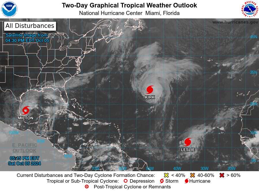
National Hurricane Center image
As of Saturday afternoon, the National Hurricane Center, the storm has a a name: Tropical Storm Milton, and is forecast to achieve hurricane strength as it moves eastward toward the Florida peninsula:
“Maximum sustained winds are near 40 mph (65 km/h) with higher gusts. Steady to rapid strengthening is forecast during the next few days. Milton is forecast to become a hurricane Sunday night, and it could become a major hurricane while it moves across the central and eastern Gulf of Mexico.
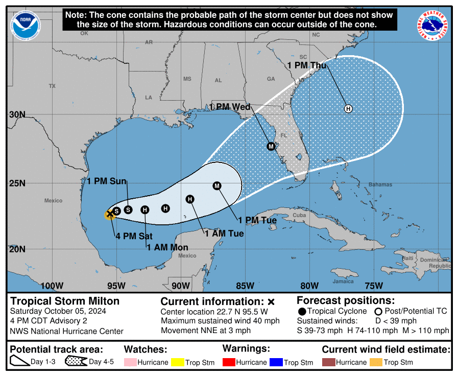
Forecast track for Tropical Storm/Hurricane Milton, as of 5 p.m. Saturday, October 5, 2024
National Hurricane Center image
“There’s general agreement that it will begin to drift east toward the Florida peninsula, with rainfall beginning on Sunday and lasting for days,” McNoldy explains.