The challenges facing local news organizations are very real. That's why reader support matters more than ever. If you believe independent journalism matters, make a contribution today and help us reach our summer fundraising goal of $10,000 by August 9.
Hurricane Helene officially formed on Wednesday in the Gulf of Mexico. Threatening to make landfall as the strongest storm to hit the United States in more than a year, Helene strengthened to a Category 2 storm this morning and is forecast to continue intensifying before slamming Florida’s west coast as a powerful Category 3 or 4 storm this evening.
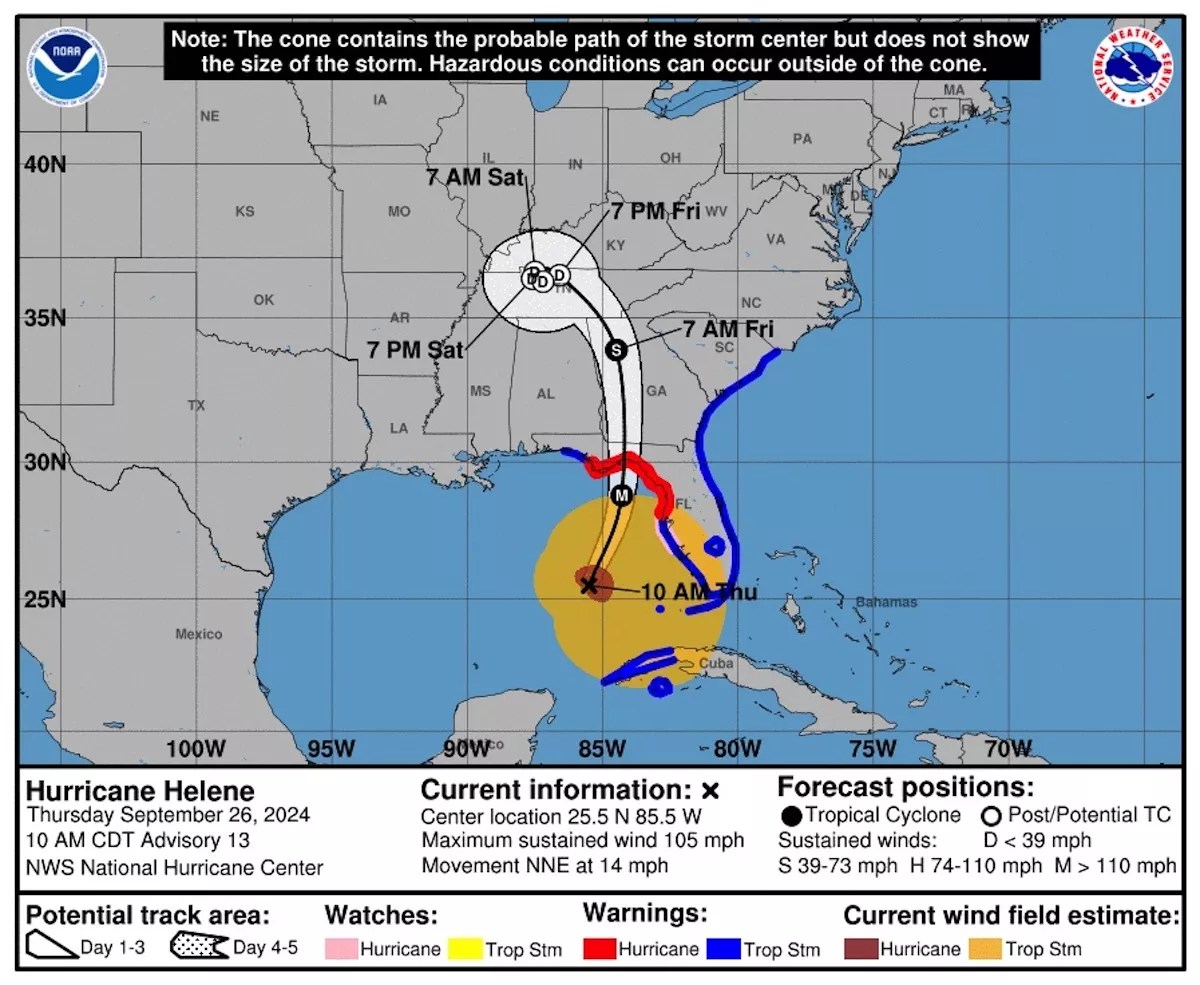
Helene’s current path projects her to make landfall tonight in Florida’s Big Bend region.
Forecasters warn that the storm will bring life-threatening conditions and heavy rains across the state – with some areas potentially facing a “catastrophic” storm surge of more than 20 feet.
Catch up on the latest
Sign up for our free weekly newsletter for a recap on politics, dining, culture, music and more
“This will not be a survivable event for those in coastal or low lying areas,” Wakulla County Sheriff Jared Miller warned residents in a Facebook post.
Hurricane Helene Tracker Map
Hurricane Helene is projected to make landfall tonight in Florida’s Big Bend region.
National Hurricane Center graphic
As of 11 a.m. on Thursday, Helene was situated about 255 miles southwest of Tampa.
The NHC’s 11 a.m. advisory wasn’t much different from the prior dispatch. The hurricane center reiterated its warning that Helene was strengthening and admonished Floridians in its path that “preparations to protect life and property should be rushed to completion.”
advertisement
advertisement
As the agency had already warned, the latest NHC advisory noted that “the combination of a life-threatening storm surge and the tide will cause normally dry areas near the coast to be flooded by rising waters moving inland from the shoreline.”
Particularly in the Panhandle, that could bring storm-surge levels of 15 to 20 feet in some areas – even higher than previously forecast.
According to the latest advisory, which describes Helene as a “very large hurricane” with hurricane-force winds extending outward up to 60 miles from her center, the storm is expected to see a “significant increase in forward speed” over the next 24 hours.
After landfall in Florida’s Big Bend area, Helene is expected to turn northwestward and slow down over the Tennessee
Valley on Friday and Saturday, the advisory notes.
advertisement
“Weakening is expected after landfall, but Helene’s fast forward speed will allow strong, damaging winds, especially in gusts, to penetrate well inland across the southeastern United States, including over the higher terrain of the southern Appalachians,” the advisory reads.
What About South Florida?
That would seem to be serious enough for a Miamian to wonder whether this will affect us in South Florida.
The short answer: Yes, but.
advertisement
advertisement
New Times‘ go-to meteorologist Brian McNoldy assures that Helene’s fury will indeed be felt in South Florida owing to the storm’s massive size.
Conditions are expected to deteriorate across South Florida tonight and into Thursday.
“It’s going to be passing pretty far to our west, but it’s big, so we will absolutely feel some effects from it here,” McNoldy told us.
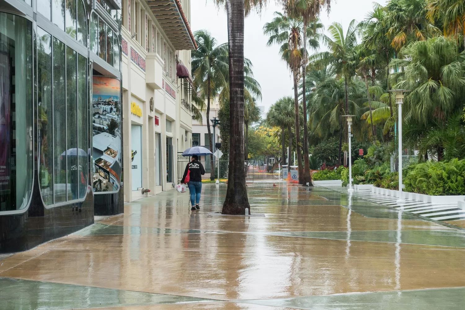
Although South Florida will likely start to see high chances of heavy rain and 15-to-20-mph sustained winds when the storm passes closest to us on Thursday, McNoldy says the odds of tropical storm conditions here are “very, very, slim.”
advertisement
In order to be counted as a tropical storm locally, he explains, the area would need to see sustained winds of about 40 mph.
“Right now it just does not look like it’s going to happen,” McNoldy says.
Another bright side?
The storm itself is going to be moving relatively rapidly – meaning that whatever effects we experience will quickly vanish, too, McNoldy says.
“I don’t expect anything too out of the ordinary for what we have gone through lots of times here,” says the meteorologist. “Just be smart. Exercise some caution. If it’s really windy, you probably don’t want to be standing underneath trees. That sort of thing.”
Editor’s note: This story is based on forecasts current as of 11 a.m. on Thursday, September 26. It will be updated as events warrant.
advertisement
Independent Journalism in Miami Needs You
The article you just read is made possible by a mix of advertising, sponsorships and reader support. As advertising revenue continues to shift, reader support plays a vital role in sustaining the reporting, investigations, restaurant and arts coverage, and storytelling our community relies on. Become a member today and help keep our journalism free and independent.
Alex DeLuca is a staff writer at Miami New Times. She previously interned for the South Florida Sun Sentinel and freelanced for The Appeal. She holds a bachelor’s degree from the College of Journalism and Communications at the University of Florida.