
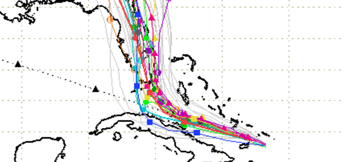
via Spaghettimodels.com

Audio By Carbonatix
If you’ve ever lived in South Florida during hurricane season, chances are you’ve learned to read the various storm projection models like a
Well, the latest model runs are out this morning and they don’t leave much room for interpretation: Hurricane Irma is going to make a direct landfall in South Florida. Almost every model is now in agreement on that, with the only question being exactly where the
Little has changed in NOAA’s 8 a.m. advisory, although the weather agency has downgraded the huge storm to a Category 4 as its maximum winds dip to 165 miles per hour. Don’t take much comfort in that – practically speaking, there’s not much difference between 185 and 165 mph winds, and NOAA expects the storm to wobble between a 4 and 5 before hitting Florida.
The latest tracking models all agree Irma will turn sharply north on Saturday morning. Depending exactly where that turn happens – the storm will then barrel right into Florida.
“On the forecast track, the eye of Irma should move near the north coast of Cuba and the central Bahamas today and Saturday, and be near the Florida Keys and the southern Florida Peninsula Sunday morning,” NOAA writes.
The agency’s official warning cone now includes the entire state of Florida, barring a tiny piece of the western panhandle. Irma is poised to hit the Sunshine State like no other storm in history:

via NOAA
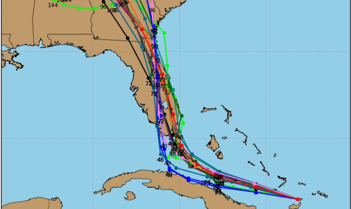
Here’s another glimpse of the various models NOAA uses to make that forecast. While there’s still variation between whether the eye of the storm hits the Gulf Coast or the Atlantic Coast, Irma looks like a dead-sure bet to roll right into the southern tip of Florida:
via NOAA
What that means, of course, is that right now everyone south of Orlando needs to brace for a major impact. And Orlando and the northern half of Florida is probably next in line for a major impact.
7am Fri 9/8: Hurricane #Irma expected to hit South Florida Saturday through Monday. Preparations should be complete by tonight! #FLwx pic.twitter.com/S9C146UamW
— NWS Miami (@NWSMiami) September 8, 2017