
NOAA

Audio By Carbonatix
Keep Miami New Times Free
We’re aiming to raise $7,500 by April 26. Your support ensures Miami New Times can continue watching out for you and our community. No paywall. Always accessible. Daily online and weekly in print.
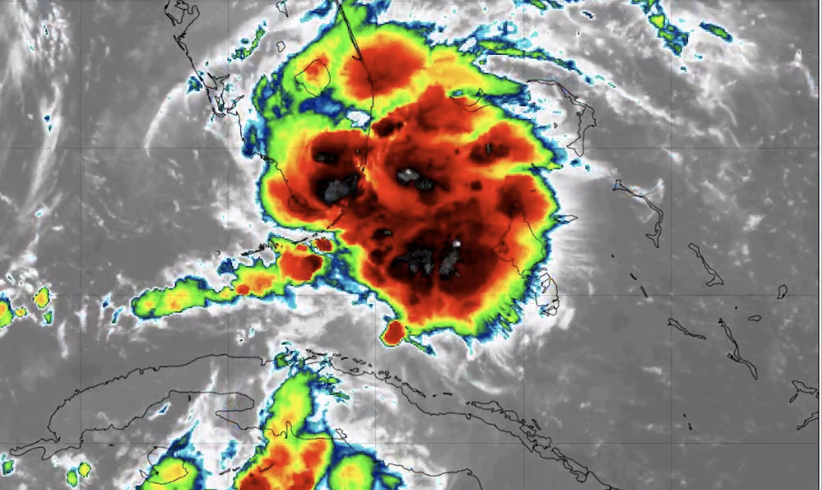
Miami was already bracing for a miserable Labor Day thanks to a tropical wave blowing out of the Caribbean. But as of 8:30 a.m., the National Hurricane Center says the weather is actually going to be worse than predicted – that wave has now formed into Tropical Storm Gordon over the upper Keys.
All of South Florida is now under a tropical storm warning. In the immediate future, hurricane forecasters say North Dade and Broward face winds up to 55 mph and stinging rain until 9:15 a.m. as a line of heavy storms tears through the area.
NOAA
More damaging waves from Gordon will spin over the region throughout the day, and a flood watch is in effect until 11 p.m.
On Twitter, locals have spent the morning posting videos of the storm blasting Miami with downpours and heavy winds:
This wind and rain is intense #miami #flwx@OfficialJoelF pic.twitter.com/YLWCMhOsvR
— Ryan RC Rea (@volvoshine) September 3, 2018
Miami Beach as we speak (chat) #storm #Cyclone #Miami #beach #wind @carlitoj95 pic.twitter.com/uoHnx6boEE
— Carlos (@CRdeGR) September 3, 2018
Although the center of Gordon is technically over the Keys, Miami-Dade is taking the brunt of the storm this morning as its rotation slams storms into the coast:
You can track the center of Tropical Storm #Gordon on this radar loop courtesy of @SFWMD. A little past 8 it’s located west of Key Largo, skirting along the southernmost Everglades. The most active side of Gordon striking metro South Florida, but leaving #FLKeys unscathed. pic.twitter.com/SZKasqqpn8
— John Morales (@JohnMoralesNBC6) September 3, 2018
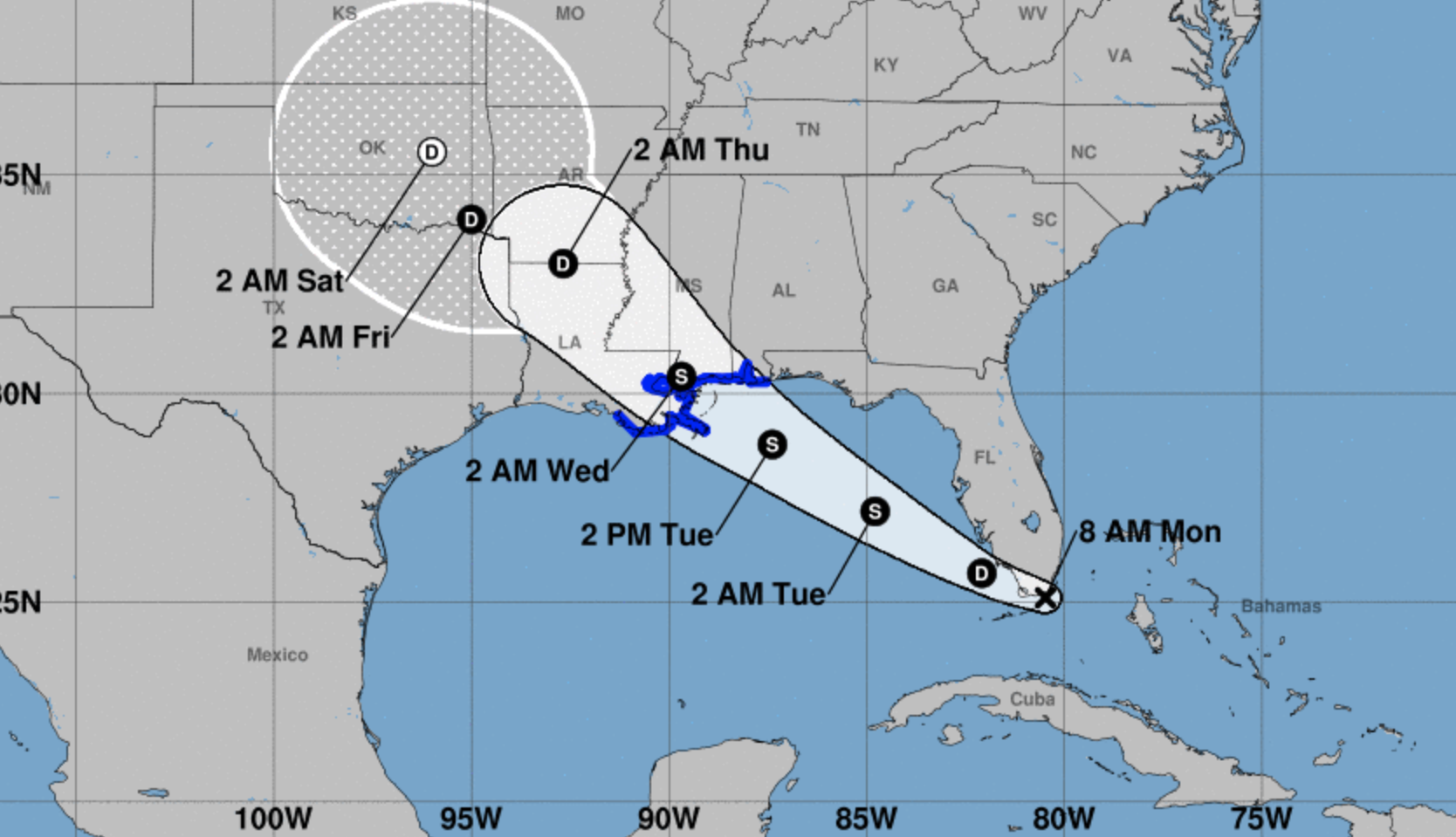
Forecasters expect Gordon to strengthen over the Gulf of Mexico this week. A tropical storm warning is in effect for parts of the Alabama and Louisiana coastlines.