
National Weather Service

Audio By Carbonatix
Keep Miami New Times Free
We’re aiming to raise $7,500 by April 26. Your support ensures New Times can continue watching out for you and our community. No paywall. Always accessible. Daily online and weekly in print.
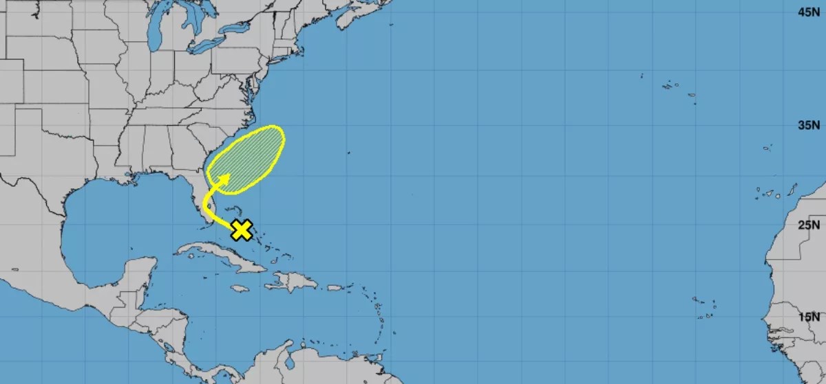
Just in time for the weekend, a tropical disturbance moving through the Atlantic is expected to dump massive amounts of rain on Miami. Although we’re still one month away from the official start of hurricane season, the National Weather Service says a weak disturbance is passing over the northwestern Bahamas and will move into South Florida over the next few days.
All that amounts to a soggy weekend: The forecast currently calls for at least some chance of rain and thunderstorms through next Wednesday. The National Weather Service says heavy rainfall is its primary concern for Florida. Meteorologists have warned some areas may flood – particularly those with a history of poor drainage, such as low-lying sections of Brickell, Coconut Grove, and Miami Beach.
The storm system will also affect weekend plans for boating or swimming. The hazardous weather outlook for South Florida says there’s a high risk of life-threatening rip currents for all Atlantic beaches, and waves could reach as high as seven feet. The forecast also includes a slight chance of waterspouts. Swimming is not recommended.
5/1 @ 10 am – A Disturbance now over the NW Bahamas will bring us heavy rainfall and hazardous swimming/boating conditions over the next few days. Flooding of poorly drained areas is possible. #flwx pic.twitter.com/mHWCuVItfm
— NWS Miami (@NWSMiami) May 1, 2019
The 2019 hurricane season officially begins June 1. AccuWeather forecasters are predicting a normal to above-average season with 12 to 14 storms, including two to four that could become major hurricanes. The first named storm of the year will be called Andrea, followed by Barry, Chantal, and Dorian.
The intensity of the storms in many ways depends on the El Niño and La Niña weather patterns.
“If this current El Niño continues or strengthens, then the number of tropical storms and hurricanes will be near or below normal,” says Dan Kottlowski, an Atlantic hurricane expert with AccuWeather. “If the El Niño weakens and goes neutral, the number of tropical storms and hurricanes could actually be higher than normal.”
This weekend’s tropical disturbance isn’t likely to become a larger storm, however. The National Weather Service says the system has a “near 0% chance” of tropical development.