
Photo by maxstrz / Flickr

Audio By Carbonatix
Keep Miami New Times Free
We’re aiming to raise $7,500 by April 26. Your support ensures Miami New Times can continue watching out for you and our community. No paywall. Always accessible. Daily online and weekly in print.
Here’s the good news for Miami: A tropical wave rolling off Nicaragua that now has a 90 percent chance of morphing into a named storm probably won’t hit South Florida. Instead, the system is expected to clip the Yucatán Peninsula and head north before possibly hitting the Panhandle or Louisiana by this weekend.
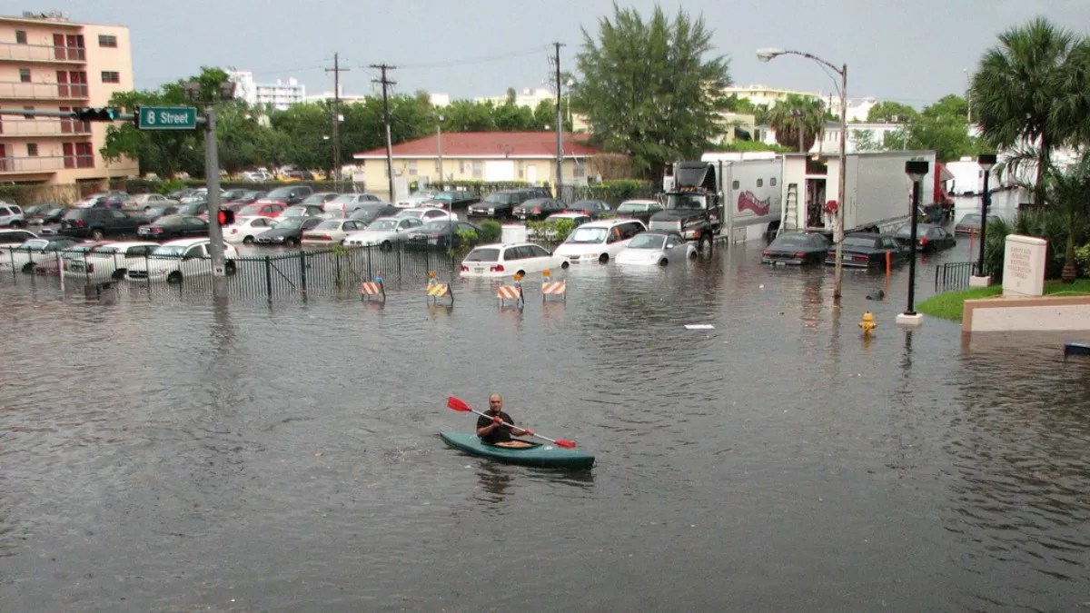
The very bad news for Miami is that another low-pressure system over the Straits of Florida will hammer us with rain through Saturday — just as king tides are beginning to peak around the coast. That means it’s probably a good time to dust off your kayak if you live in a flood-prone area.
“Flooding [is] likely this week,” NBC 6’s John Morales warns on Twitter. “Be ready.”
Even without a bout of nasty tropical moisture ready to dump all over South Florida, this week was set to be challenging for nonamphibians thanks to the annual king tides. The City of Miami Beach has installed a $400 million pumping system in part to help deal with the huge tides, which in recent years have led to mass “sunny-day” flooding on the barrier island.
Those tides will begin peaking tomorrow and last through the weekend:
For more info on times of future king tides & additional tips on how to stay safe, please visit https://t.co/6G4TRVBLm1 #MBRisingAbove pic.twitter.com/qyfhBeDTqn
— City of Miami Beach (@MiamiBeachNews) October 4, 2017
The timing really couldn’t be worse. Although Miami won’t be battered by an official tropical storm, forecasters say the rest of the week will be marked by howling winds and up to three inches of rain thanks to a low-pressure system parked over west-central Cuba and the Florida Straits.
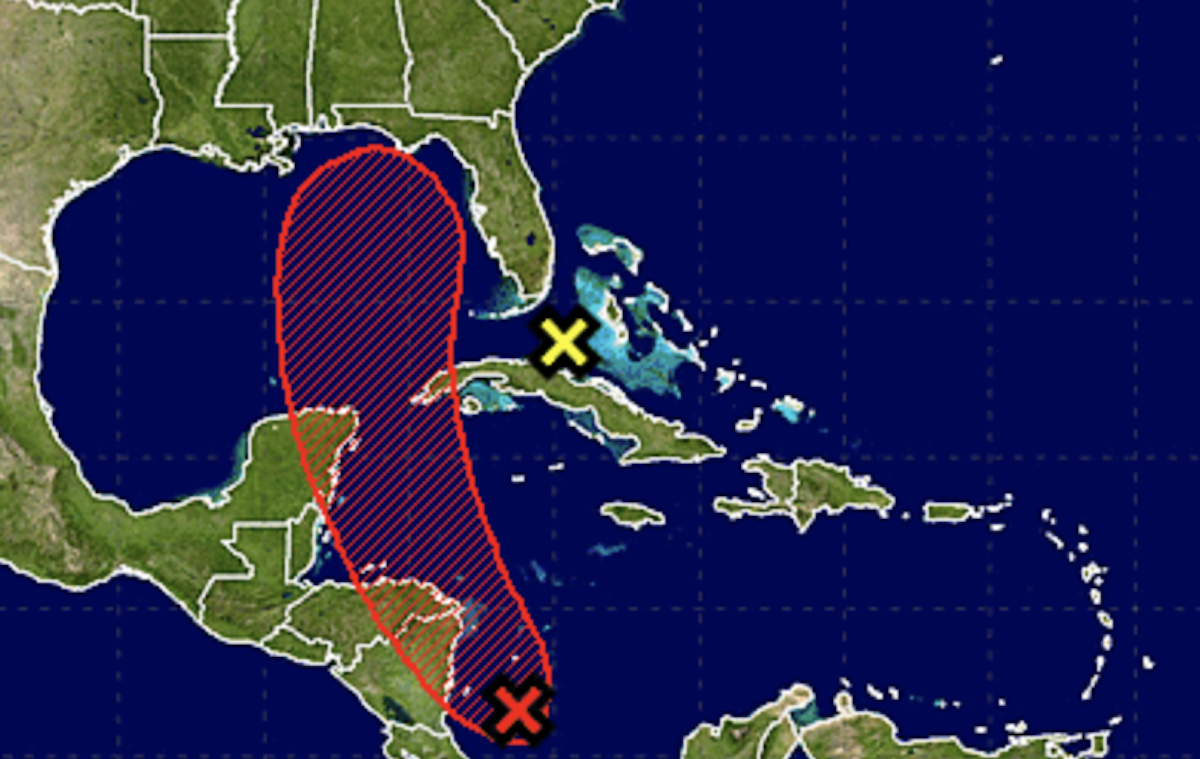
via NOAA
NOAA forecasters now give that unnamed low-pressure system no chance of developing into anything stronger thanks to high-level winds, but the system will still dump plenty of rain on Miami.
“Although significant tropical development of this system is not expected due to strong upper-level winds, brief
squalls will likely produce locally heavy rainfall and strong gusty winds over portions of the Bahamas and the southern Florida peninsula during the next couple of days,” NOAA writes in its 8 a.m. advisory.
Adding all of that extra rainfall to already superhigh tides could be a bad mix beginning tomorrow:
Water woes this week in South Florida: Numerous showers this afternoon through Wed then widespread heavier rains Wed night thru early Fri. Water won't drain easily due to #KingTide. This @NWSMiami forecast came with a note: locally *much* higher amounts possible. Flooding likely! pic.twitter.com/7cfd4Onwc1
— John Morales (@JohnMoralesNBC6) October 3, 2017
Welcome to the 2017 hurricane season in Miami: Even when the worst of the weather misses us, we’ll still probably need aquatic transit to get to work.