
Photo by Joe Raedle/Getty Images

Audio By Carbonatix
Advertising Can't Do It Alone
The challenges facing local news organizations are very real. That's why reader support matters more than ever. If you believe independent journalism matters, make a contribution today and help us reach our summer fundraising goal of $10,000 by August 9.
Update 6/13/2024 5:03 p.m.: Broward County is under a flash flood warning until 8 p.m. The area could see an additional 3 to 6 inches of rain tonight.
Update 6/13/2024 3:30 p.m.: Fort Lauderdale could receive an additional 10 to 12 inches of rain between 3 p.m. and 7 p.m. as storms roll into the area, according to the latest NWS Miami forecast.
In a post on X, formerly known as Twitter, the City of Fort Lauderdale warned that with over 11 inches of rainfall in the past 48 hours, the area is primed for quicker flooding once the rain resumes.
3:00 p.m. Update, Thursday, June 13
The latest forecast from the National Weather Service predicts that Fort Lauderdale will receive an additional 10-12 inches of rain between 3 p.m. and 7 p.m. as storms move into our area from the west.
The groundwater table is nearly… pic.twitter.com/z0dh9gJWON
— City of Fort Lauderdale (@FTLCityNews) June 13, 2024
“Stay off the roadways today unless absolutely necessary,” the post reads.
Update 6/13/2024 3:10 p.m.: Parts of Miami-Dade and Broward are at high risk for excessive rainfall this afternoon. NWS Miami urges people to stay indoors as “locally catastrophic flash flooding is possible.”
A HIGH Risk of Excessive Rainfall (4/4 risk) has been issued for the I-75 Corridor. This means that widespread flash flooding is expected.
*Locally catastrophic flash flooding is possible.*
The latest thoughts from the Weather Prediction Center in a mesoscale discussion below. https://t.co/Wmc9lmyOLG pic.twitter.com/hHmiUdef9i
— NWS Miami (@NWSMiami) June 13, 2024
Update 6/13/2024 1:50 p.m.: Royal Caribbean’s chief meteorologist Craig Setzer warned early Thursday afternoon that heavy rainfall was on the way to Broward and Miami-Dade counties.
He says that by mid-afternoon, people will want to stay off the road, as flooded streets are possible.
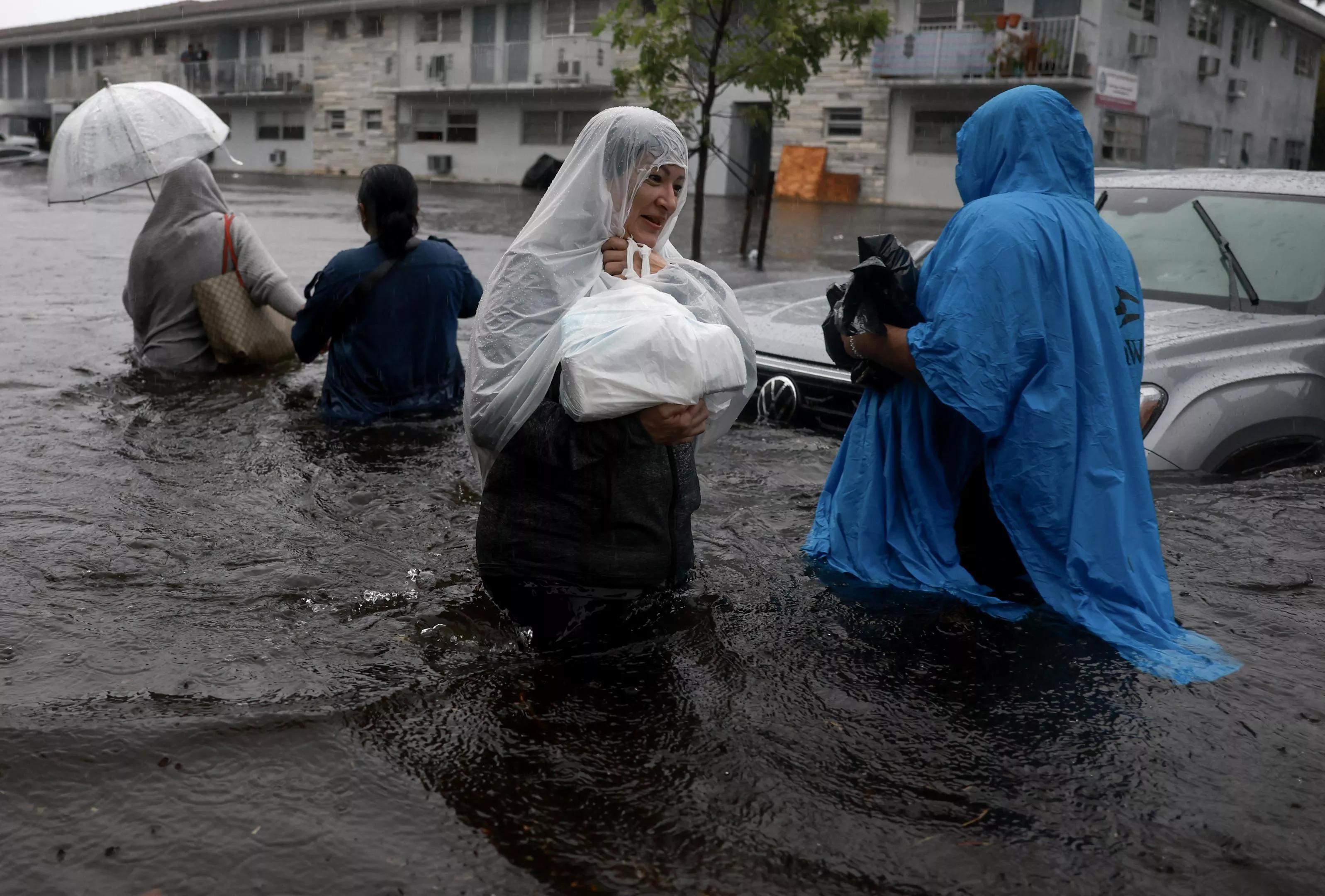
Following several days of relentless storms that spawned flooding and hazardous conditions across South Florida, today’s forecast offers little reprieve.
After numerous flash flood emergencies were issued across the region yesterday – including in Fort Lauderdale, which saw a stunning 9.5 inches of rainfall – South Floridians can expect more heavy rainfall across the region today, including “life-threatening flooding” that could develop this afternoon, according to the latest National Weather Service (NWS) forecast.
The forecast says that scattered thunderstorms will develop over the region, some of which could bring gusty winds, heavy downpours, and even a few weak tornadoes. A flood watch remains in effect until Friday.
“With multiple rounds of heavy rainfall likely across the region today, significant and life-threatening flash flooding will be possible once again especially across the areas where flooding has already occurred from the past several days,” the forecast reads.
In a post on X, formerly known as Twitter, the weather service noted that a high risk of excessive rainfall has been issued for the I-75 corridor – meaning that widespread flash flooding, including in areas that don’t typically experience flooding, is expected.
(06-13 at 3:05 PM): An expansive line of thunderstorms is slowly progressing in its trek to the east. The line of storms will affect Palm Beach County first, then Broward, and then Miami-Dade County. Use caution if on the roadways this afternoon/evening! #MFLWx pic.twitter.com/tikWDcs7wu
— NWS Miami (@NWSMiami) June 13, 2024
This is a breaking story. Please check back for updates.