
via NWS Miami

Audio By Carbonatix
Logging into
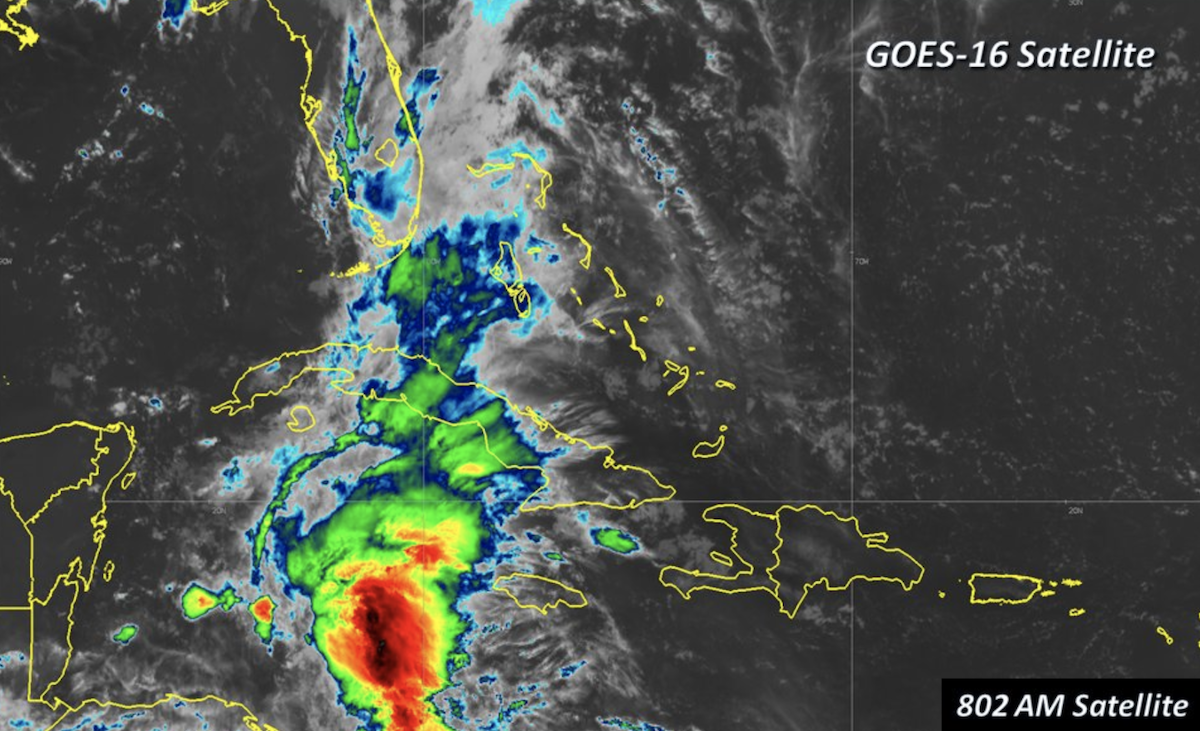
Hurricane watchers have been monitoring a huge system of storms in the Caribbean, and this morning the National Hurricane Center upgraded the system’s chances of organizing into a named storm to 40 percent. Either way, the bad weather will likely dump a deluge onto South Florida by the end of the week.
For now, the system is a “surface low” just east of Belize, but it’s already producing rain from Cuba north to Florida.
“This system is unusually moist… and is bringing disorganized thunderstorms with very heavy rain to the region,” Jeff Masters at the Weather Underground writes.
Forecasters say strong upper-level winds and dry air should prevent the system from organizing too quickly into a full-blown tropical storm, but that could change later this week.
“Some gradual subtropical or tropical development is possible late this week while the system moves slowly northward into the central or eastern Gulf of Mexico,” the NHC says in its 7:45 a.m. update.

via National Weather Service Miami
Masters writes that about 40 percent of modeling programs show the storm developing into a cyclone, mostly in the upper Gulf of Mexico toward Louisiana. That wouldn’t happen until Thursday at the earliest, he notes.
Whatever the system ends up doing, there’s a decent chance it unleashes a ton more rain on already-sopping-wet South Florida.
“Regardless of development, locally heavy rainfall is possible across western Cuba, the Cayman Islands, and much of Florida during the next several days,” the NHC says.