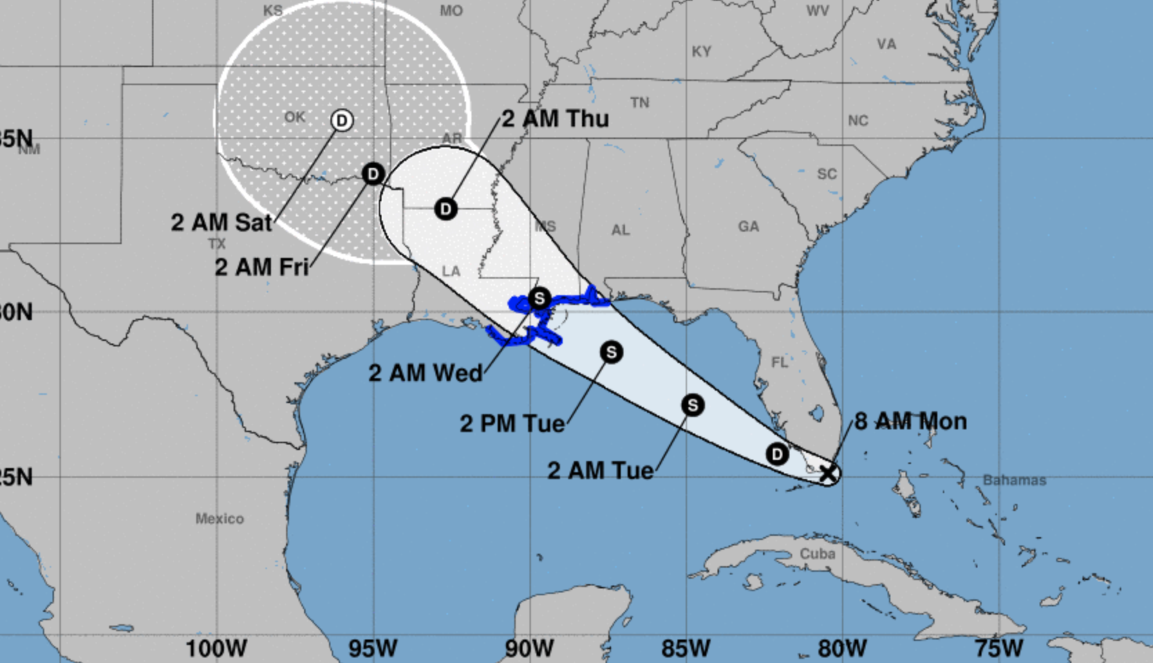
All of South Florida is now under a tropical storm warning. In the immediate future, hurricane forecasters say North Dade and Broward face winds up to 55 mph and stinging rain until 9:15 a.m. as a line of heavy storms tears through the area.
More damaging waves from Gordon will spin over the region throughout the day, and a flood watch is in effect until 11 p.m.
On Twitter, locals have spent the morning posting videos of the storm blasting Miami with downpours and heavy winds:
This wind and rain is intense #miami #flwx@OfficialJoelF pic.twitter.com/YLWCMhOsvR
— Ryan RC Rea (@volvoshine) September 3, 2018
Although the center of Gordon is technically over the Keys, Miami-Dade is taking the brunt of the storm this morning as its rotation slams storms into the coast:Miami Beach as we speak (chat) #storm #Cyclone #Miami #beach #wind @carlitoj95 pic.twitter.com/uoHnx6boEE
— Carlos (@CRdeGR) September 3, 2018
Forecasters expect Gordon to strengthen over the Gulf of Mexico this week. A tropical storm warning is in effect for parts of the Alabama and Louisiana coastlines.You can track the center of Tropical Storm #Gordon on this radar loop courtesy of @SFWMD. A little past 8 it’s located west of Key Largo, skirting along the southernmost Everglades. The most active side of Gordon striking metro South Florida, but leaving #FLKeys unscathed. pic.twitter.com/SZKasqqpn8
— John Morales (@JohnMoralesNBC6) September 3, 2018