
BEST NATURAL HIGH
Interstate 95
BEST PLACE TO UNPLUG
Crandon Park Beach
BEST TOPLESS BEACH
Depends
BEST PLACE TO HIKE
Pine Glades Lake Trail
BEST PLACE TO BIRDWATCH
Dump Marsh
BEST PICNIC SPOT
Fairchild Tropical Garden
BEST PLACE TO MOUNTAIN BIKE
Oleta River State Recreation Area
BEST PUBLIC PARK
Crandon Park
BEST PUBLIC PARK FOR SANTERĺA RITUALS
Sewell Park
BEST HIDDEN PARK
Legion Memorial Park
Best Of Miami®

-
Arts & Entertainment
-
BEST CONCERT SERIES
New World Symphony's Sounds of the Times
-
SECOND-BEST CONCERT SERIES
Rhythm Foundation
-
BEST LOCAL SOLO MUSICIAN
Nicole Henry
-
BEST VENUE FOR LIVE MUSIC
Lincoln Theatre
-
BEST LOCAL ROCK BAND
Moxi
-
BEST NEW MUSIC TREND
The return of house music
-
BEST CLASSICAL RADIO PROGRAM
The Classical Hour on WVUM-FM (90.5)
-
BEST LOCAL POP BAND
Shufly
-
BEST RADIO STATION
Power 96 WPOW-FM (96.5)
-
BEST WE-GOT-THE-FUNK COLLECTIVE
The Square Egg
-
BEST LOCAL INDIE BAND
See Venus
-
BEST MOVIE THEATER
Intracoastal Cinema
-
BEST ART CINEMA
Bill Cosford Cinema
-
BEST PIANO MAN
Eddie Higgins
-
BEST ART CHAT
Pillow Talk
Beach House Bal Harbour
-
BEST LOCAL ALBUM OF THE LAST TWELVE MONTHS
Strokes Is For Dopes
Curious Hair
-
BEST RAP ALBUM YOU NEVER HEARD
Dirty Life
X-Con
-
BEST TV STATION
City of Miami Television (Channel 9)
-
BEST FILM FESTIVAL
Gay and Lesbian Film Festival
-
BEST LOCAL ELECTRONICA RELEASE
Live at Fuácata
Spam Allstars
-
BEST PIT STOP
Wayside Fruit and Vegetable
-
BEST REGGAE RADIO PROGRAM
Jamusa
WAVS-AM (1170)
Wednesday, Thursday, Friday evening drive time
-
BEST CONCERT OF THE PAST TWELVE MONTHS
The Strokes at Billboardlive
-
BEST PIT STOP ON THE WAY TO KEY WEST
The Lor-e-lei
Mile Marker 82
-
BEST LOCAL SPORTS COACH
Larry Coker
University of Miami football
-
SECOND BEST CONCERT OF THE PAST TWELVE MONTHS
Jay-Z at Billboardlive
-
BEST BAND NAME
Moxi
-
BEST TOURIST TRAP
Casa Casuarina
-
BEST ALTERNATIVE USE OF GALLERY SPACE
Artemis (lab6 and PS 742)
-
BEST ROCK RADIO PROGRAM
¡Boom! Radio
-
BEST HAITIAN RADIO UPGRADE
Radio Carnivale
WRHB-AM (1020)
-
BEST JAZZ RADIO PROGRAM
Weekend Jazz Saturday with Tracy Fields
-
BEST ART GALLERY
Fredric Snitzer Gallery
-
BEST LOCAL NOISE BAND
Rat Bastard and the Laundry Room Squelchers
-
BEST NEW FILM TREND
Free film-festival movies on the sand
-
BEST RECORD LABEL
Substance
-
BEST LOCAL SONGWRITERS
Elsten Torres and Juan Carlos Perez Soto
-
BEST MUSEUM
Bass Museum of Art
-
BEST BOOK BY A LOCAL AUTHOR
Florida Poems
By Campbell McGrath
-
BEST LOCAL LATIN SINGER
Jorge Moreno
-
BEST LOCAL ACOUSTIC PERFORMER
Dean Fields
-
BEST PULP FICTION
Mob Over Miami
By Michele McPhee
-
BEST LOCAL ARTIST
William Cordova
-
BEST LOCAL HAITIAN BAND
Saima
-
BEST LOCAL ELECTRONICA ARTIST
Funky Green Dogs
-
BEST NEW ARTIST
Kristen Thiele
-
BEST EMERGING ARTIST
Norberto Rodriguez
-
BEST ROCKABILLY BAND
Lil' Jake and the Boss Tones
-
BEST LOCAL RAP GROUP
Trick Daddy
-
BEST LOCAL WRITER
Ricardo Pau-Llosa
-
BEST DRAG QUEEN
Elaine Lancaster
-
BEST LOCAL CARIBBEAN BAND
Afro-Polyphonic World Orchestra
-
BEST LOCAL JAZZ ARTIST
Spam Allstars
-
BEST TV NEWS ANCHOR
Laurie Jennings
WSVN-TV (Channel 7)
-
BEST INDIE NIGHT
PopLife
Saturday nights at Piccadilly Garden
-
BEST TV NEWS REPORTER
Benno Schmidt
NBC 6 (WTVJ-TV)
-
BEST LITTLE MAGAZINE FOR LITTLE MINDS
Ego Trip
-
BEST LOCAL LATIN BAND
Manolin
-
BEST LATIN ROCK BAND
Volumen Cero
-
BEST LOCAL ZINE
OpenZine
-
BEST HURRICANES FOOTBALL PLAYER
Ed Reed
-
BEST PANTHERS PLAYER
Robert Luongo
-
BEST DOLPHINS PLAYER
Ricky Williams
-
BEST HEAT PLAYER
Alonzo Mourning
-
BEST MARLINS PLAYER
Josh Beckett
-
BEST RIVALRY
Gwen Cherry Bulls vs. Liberty City Warriors
-
BEST BEANBALL
John Henry
-
BEST WEATHERCASTER
Don Noe
WPLG-TV (Channel 10)
-
BEST AM RADIO PERSONALITY
Alberto Milian
-
BEST FM RADIO PERSONALITY
Lita
Power 96 (WPOW-FM 96.5)
-
BEST SPANISH-LANGUAGE RADIO PERSONALITY
Ninoska Perez Castellon
Ninoska a la una
WQBA-AM (1140)
-
BEST COSTUME DESIGN
Ilona Somogyi
Red Herring
Florida Stage
-
BEST STAGE DESIGN
Victor Becker
Black Sheep
Florida Stage
-
BEST THEATER FOR DRAMA
Florida Stage
-
BEST ENSEMBLE CAST
Red Herring
Florida Stage
-
BEST BLACK-BOX PRODUCTION
audiovideo
Juggerknot Theatre Company
-
BEST LOCALLY PRODUCED STAGE COMEDY
Here in My Car
Mad Cat Productions
Miami Light Project's Light Box Theatre
-
BEST SUPPORTING ACTOR
Paul Tei
Black Sheep
Florida Stage
-
BEST SUPPORTING ACTRESS
Brenda Thomas
Bee-luther-hatchee
Florida Stage
-
BEST SOLO PERFORMANCE
Teo Castellanos
NE 2nd Avenue
-
BEST ACTRESS
Pamela Roza
Boy Gets Girl
GableStage
-
BEST ACTOR
Peter Haig
Someone Who'll Watch Over Me
-
BEST LOCAL DIRECTOR
Joe Adler
GableStage
-
BEST SPANISH-LANGUAGE PRODUCTION
Cenizas Sobre el Mar
Teatro Avante
-
BEST LOCALLY PRODUCED DRAMA
The Play About the Baby
GableStage
-
BEST SHOT IN THE ARM FOR LOCAL BOXING
Sugar Ray Leonard
-
BEST TWENTY-FOUR-HOUR FASHION SHOW
Fashion TV
-
BEST SPORTSCASTER
Jimmy Cefalo
WPLG-TV (Channel 10)
-
BEST LOCAL WEBSITE
www.clubhoppers.net
-
SECOND-BEST LOCAL WEBSITE
www.cooljunkie.com
-
BEST FILM SERIES
Cuban Cinema Series
Miami-Dade Community College
-
BEST TRADE (SPORTS TEAM)
Florida Marlins owner John Henry to the Boston Red Sox
-
BEST MISSED OPPORTUNITY
Miami Fusion
-
BEST NEW OLDIES JAZZ STATION
104.1 FM
-
BEST METEOROLOGICAL TREAT
Clouds
-
BEST BEATLES CORRESPONDENCE
Hard Rock Café
Bayside Marketplace
-
-
Eat & Drink
-
BEST NEW RESTAURANT
Nobu - Shore Club Hotel
-
BEST SUSHI
Siam Bayshore Gourmet Thai Food Restaurant
-
BEST CHOCOLATE
The Sweet Tooth
-
BEST HAPPY HOUR
Houston's
-
BEST JAMAICAN RESTAURANT
Clive's Café
-
BEST SODA BREAD
JohnMartin's Restaurant & Irish Pub
-
BEST CHEAP CRUSTACEANS
Lobster Night
Tobacco Road
-
BEST DIM SUM
Kon Chau
-
BEST APPLE-BACON-CHEESE SANDWICH
Deli Lane Café
-
BEST UNKNOWN RESTAURANT
Little Havana
-
BEST BRAZILIAN RESTAURANT
Picanha's Grille
-
BEST ICE CREAM PARLOR
Coco Gelato
-
BEST ALL-YOU-CAN-EAT LUNCH BUFFET
-
BEST FLAN
Joe's Stone Crab
-
BEST CHAIN RESTAURANT
On the Border Mexican Grill & Cantina
-
BEST CROISSANT
La Brioche Doree
4017 Prairie Avenue
Miami Beach
305-538-4770
-
BEST BUDGET RESTAURANT
International House of Pancakes
-
BEST TAKE-OUT GOURMET AND CAFé FOOD
Stephans Art & Design Café
-
BEST RESTAURANT FOR GLUTTONS
Emerald Coast Chinese Gourmet Buffet
-
BEST TAKE-OUT CHICKEN
El Palacio de los Jugos
-
BEST CUBAN RESTAURANT
Casa Romeu
-
BEST LEMONADE
Total Juice Plus
-
BEST HOMESTYLE CUBAN RESTAURANT
El Nuevo Siglo Supermarket lunch counter
-
BEST RAW BAR
Nemo
-
BEST BLACK BEAN SOUP
Ayestaran Restaurant
-
BEST STEAKHOUSE
Graziano's Parrilla Argentina
-
BEST CEVICHE
Sushi Samba Dromo
-
BEST RESTAURANT FOR INTIMATE CONVERSATION
Shula's Steak House
Alexander Hotel
-
BEST HAMBURGER
Arnold's Royal Castle
-
BEST WINE SELECTION IN A RESTAURANT
Brasserie Les Halles
-
BEST CARIBBEAN RESTAURANT
Ortanique on the Mile
-
BEST PIZZA
The Sicilian Gourmet Pizzeria
-
BEST COFFEEHOUSE
5061 Eaterie & Deli
-
BEST GOURMET PIZZA
Andiamo Brick Oven Pizza
-
BEST CORKAGE FEE
Su-Shin
-
BEST PLACE TO GRAB A SLICE OF PIZZA
Steve's Pizza
-
BEST DINER
Jimmy's East-Side Diner
-
BEST PREPARED FOODS
Gourmet Station
-
BEST SEAFOOD RESTAURANT
Fico Key West Seafood
-
BEST TACO
El Toro Taco
-
BEST CULINARY OXYMORON
McDonald's Cuban Sandwich
-
BEST RESTAURANT FOR A POWER LUNCH
Rusty Pelican
-
BEST MICROBREWED BEER
Thai Orchid Restaurant
-
BEST WATERFRONT RESTAURANT YOU'VE NEVER HEARD OF
The Commons
-
BEST DELICATESSEN
Roasters 'N Toasters
-
BEST INEXPENSIVE WATERFRONT RESTAURANT WITH A GREAT VIEW
Pelican on the Pier, Newport Beachside Resort
-
BEST HAITIAN RESTAURANT
Holy Family Restaurant
-
BEST ROAST PORK
Hernandez Meat Distributors
-
BEST FALAFEL
Khoury's Mediterranean Restaurant
-
BEST PUERTO RICAN RESTAURANT
-
BEST EMPANADAS
Confiteria Buenos Aires Bakery & Café
-
BEST NATURAL FOOD/VEGETARIAN RESTAURANT
The Honey Tree
-
BEST BARBECUE
Shorty's Bar-B-Q
-
BEST JAPANESE RESTAURANT
Matsuri
-
BEST RESTAURANT IN COCONUT GROVE
Paulo Luigi's
-
BEST SMOOTHIE
Gables Juice Bar
-
BEST HEALTH FOOD STORE
Whole Foods Market
-
BEST RESTAURANT IN SOUTH BEACH
Nobu
Shore Club Hotel
-
BEST BREAD
Renaissance Baking Company
-
BEST RESTAURANT IN CORAL GABLES
Norman's
-
BEST INDIAN RESTAURANT
Imlee
-
BEST TV DINNER
Big Pink
-
BEST BAR FOOD
Scully's Tavern
-
BEST DRIVE-THRU CRAB
Capt. Crab's Take-Away
-
BEST CHILI
Skyline Chili
-
BEST INNOVATIVE MENU
Las Culebrinas
-
BEST KEY LIME PIE
Joe's Stone Crab
-
BEST OUTDOOR DINING
Smith & Wollensky
-
BEST KEY LIME COMESTIBLES
The Key Lime Tree
-
BEST NICARAGUAN RESTAURANT
Yambo
-
BEST CONCH FRITTER
Captain Jim's Seafood
-
BEST THAI RESTAURANT
Red Thai Room
-
BEST GREASY SPOON
Donut Gallery Restaurant
-
BEST SORBET
The Frieze Ice Cream Factory
-
BEST LATE-NIGHT SNACK
Cortadito and guava pastry at La Carreta
-
BEST SUNDAY BRUNCH
Brasserie Les Halles
-
BEST CUBAN SANDWICH
Enriqueta's Sandwich Shop
-
BEST EXPENSIVE ITALIAN RESTAURANT
Il Tulipano
-
BEST INEXPENSIVE ITALIAN RESTAURANT
Bruschetta & Co.
-
BEST LOCAL SOFT DRINK
Materva
-
BEST CARRY-OUT CHINESE
Bamboo Garden II
-
BEST LATE-NIGHT DINING
Versailles
-
BEST BAHAMIAN RESTAURANT
The Bahamian Pot Restaurant
-
BEST TAPAS
Casa Juancho
-
BEST DESSERTS
Touch
-
BEST MILKSHAKE
Picnics at Allen's Drugstore
-
BEST FRENCH FRIES
Cafe Pastis
-
BEST MEXICAN RESTAURANT
Burritos Grill Café
-
BEST CAFÉ CON LECHE
Versailles Restaurant
-
BEST FINE DINING TO DO TAKE-OUT
Shoji Sushi
-
BEST CHINESE RESTAURANT
Macau
-
BEST FRIED CHICKEN
Jumbo's
-
BEST HEALTHY FAST FOOD
Amos's Juice Bar
-
BEST PLACE TO DINE ALONE
Soyka
-
BEST DOUGHNUTS
Donut Connection
1901 NE 163rd Street
North Miami Beach
305-949-3501
-
BEST GREEK RESTAURANT
Mylos
-
BEST CAESAR SALAD
Fresco California Bistro
-
BEST SPANISH RESTAURANT
Casa Paco
-
BEST BAKERY
Icebox Café
-
BEST HAMBURGER STAND
Rocky's Cheesesteak and Cheeseburgers
-
BEST FISH SANDWICH
Scotty's Landing
-
BEST CHEESE
Milam's Market
-
BEST BAGELS
Marie & Harriet's Bagel Cove
-
BEST FRESH SEAFOOD
Casablanca Fish Market
-
BEST ASIAN GROCERY
Lucky Oriental Mart
-
BEST GOURMET GROCERY
Norman Brothers Produce
-
BEST CAFÉ CUBANO
El Pub Restaurant
-
BEST GINGER BEER
Caribbean Delight
-
BEST USE OF HOMESTEAD STRAWBERRIES
Whip 'n Dip Gourmet Ice Cream
-
BEST HOMEMADE PASTA
Laurenzo's Italian Market
-
BEST SUSHI
Siam Bayshore Gourmet Thai Food Restaurant
-
BEST CHOCOLATE
The Sweet Tooth
-
BEST SODA BREAD
JohnMartin's Restaurant & Irish Pub
-
BEST CHEAP CRUSTACEANS
Lobster Night
Tobacco Road
-
BEST APPLE-BACON-CHEESE SANDWICH
Deli Lane Café
-
BEST ICE CREAM PARLOR
Coco Gelato
-
BEST FLAN
Joe's Stone Crab
-
BEST CROISSANT
La Brioche Doree
4017 Prairie Avenue
Miami Beach
305-538-4770
-
BEST TAKE-OUT GOURMET AND CAFé FOOD
Stephans Art & Design Café
-
BEST TAKE-OUT CHICKEN
El Palacio de los Jugos
-
BEST LEMONADE
Total Juice Plus
-
BEST RAW BAR
Nemo
-
BEST BLACK BEAN SOUP
Ayestaran Restaurant
-
BEST CEVICHE
Sushi Samba Dromo
-
BEST HAMBURGER
Arnold's Royal Castle
-
BEST PIZZA
The Sicilian Gourmet Pizzeria
-
BEST GOURMET PIZZA
Andiamo Brick Oven Pizza
-
BEST PLACE TO GRAB A SLICE OF PIZZA
Steve's Pizza
-
BEST PREPARED FOODS
Gourmet Station
-
BEST TACO
El Toro Taco
-
BEST CULINARY OXYMORON
McDonald's Cuban Sandwich
-
BEST MICROBREWED BEER
Thai Orchid Restaurant
-
BEST DELICATESSEN
Roasters 'N Toasters
-
BEST ROAST PORK
Hernandez Meat Distributors
-
BEST FALAFEL
Khoury's Mediterranean Restaurant
-
BEST EMPANADAS
Confiteria Buenos Aires Bakery & Café
-
BEST BARBECUE
Shorty's Bar-B-Q
-
BEST SMOOTHIE
Gables Juice Bar
-
BEST HEALTH FOOD STORE
Whole Foods Market
-
BEST BREAD
Renaissance Baking Company
-
BEST TV DINNER
Big Pink
-
BEST DRIVE-THRU CRAB
Capt. Crab's Take-Away
-
BEST CHILI
Skyline Chili
-
BEST KEY LIME PIE
Joe's Stone Crab
-
BEST KEY LIME COMESTIBLES
The Key Lime Tree
-
BEST CONCH FRITTER
Captain Jim's Seafood
-
BEST SORBET
The Frieze Ice Cream Factory
-
BEST LATE-NIGHT SNACK
Cortadito and guava pastry at La Carreta
-
BEST CUBAN SANDWICH
Enriqueta's Sandwich Shop
-
BEST LOCAL SOFT DRINK
Materva
-
BEST CARRY-OUT CHINESE
Bamboo Garden II
-
BEST TAPAS
Casa Juancho
-
BEST MILKSHAKE
Picnics at Allen's Drugstore
-
BEST FRENCH FRIES
Café Pastis
-
BEST CAFÉ CON LECHE
Versailles Restaurant
-
BEST FRIED CHICKEN
Jumbo's
-
BEST HEALTHY FAST FOOD
Amos's Juice Bar
-
BEST DOUGHNUTS
Donut Connection
1901 NE 163rd Street
North Miami Beach
305-949-3501
-
BEST CAESAR SALAD
Fresco California Bistro
-
BEST BAKERY
Icebox Café
-
BEST FISH SANDWICH
Scotty's Landing
-
BEST CHEESE
Milam's Market
-
BEST BAGELS
Marie & Harriet's Bagel Cove
-
BEST FRESH SEAFOOD
Casablanca Fish Market
-
BEST ASIAN GROCERY
Lucky Oriental Mart
-
BEST GOURMET GROCERY
Norman Brothers Produce
-
BEST CAFÉ CUBANO
El Pub Restaurant
-
BEST GINGER BEER
Caribbean Delight
-
BEST USE OF HOMESTEAD STRAWBERRIES
Whip 'n Dip Gourmet Ice Cream
-
BEST HOMEMADE PASTA
Laurenzo's Italian Market
-
BEST NEW RESTAURANT
Nobu - Shore Club Hotel
-
BEST HAPPY HOUR
Houston's
-
BEST JAMAICAN RESTAURANT
Clive's Café
-
BEST DIM SUM
Kon Chau
-
BEST UNKNOWN RESTAURANT
Little Havana
-
BEST BRAZILIAN RESTAURANT
Picanha's Grille
-
BEST ALL-YOU-CAN-EAT LUNCH BUFFET
-
BEST CHAIN RESTAURANT
On the Border Mexican Grill & Cantina
-
BEST BUDGET RESTAURANT
International House of Pancakes
-
BEST RESTAURANT FOR GLUTTONS
Emerald Coast Chinese Gourmet Buffet
-
BEST CUBAN RESTAURANT
Casa Romeu
-
BEST HOMESTYLE CUBAN RESTAURANT
El Nuevo Siglo Supermarket lunch counter
-
BEST STEAKHOUSE
Graziano's Parrilla Argentina
-
BEST RESTAURANT FOR INTIMATE CONVERSATION
Shula's Steak House
Alexander Hotel
-
BEST WINE SELECTION IN A RESTAURANT
Brasserie Les Halles
-
BEST CARIBBEAN RESTAURANT
Ortanique on the Mile
-
BEST COFFEEHOUSE
5061 Eaterie & Deli
-
BEST CORKAGE FEE
Su-Shin
-
BEST DINER
Jimmy's East-Side Diner
-
BEST SEAFOOD RESTAURANT
Fico Key West Seafood
-
BEST RESTAURANT FOR A POWER LUNCH
Rusty Pelican
-
BEST WATERFRONT RESTAURANT YOU'VE NEVER HEARD OF
The Commons
-
BEST INEXPENSIVE WATERFRONT RESTAURANT WITH A GREAT VIEW
Pelican on the Pier, Newport Beachside Resort
-
BEST HAITIAN RESTAURANT
Holy Family Restaurant
-
BEST PUERTO RICAN RESTAURANT
-
BEST NATURAL FOOD/VEGETARIAN RESTAURANT
The Honey Tree
-
BEST JAPANESE RESTAURANT
Matsuri
-
BEST RESTAURANT IN COCONUT GROVE
Paulo Luigi's
-
BEST RESTAURANT IN SOUTH BEACH
Nobu
Shore Club Hotel
-
BEST RESTAURANT IN CORAL GABLES
Norman's
-
BEST INDIAN RESTAURANT
Imlee
-
BEST BAR FOOD
Scully's Tavern
-
BEST INNOVATIVE MENU
Las Culebrinas
-
BEST OUTDOOR DINING
Smith & Wollensky
-
BEST NICARAGUAN RESTAURANT
Yambo
-
BEST THAI RESTAURANT
Red Thai Room
-
BEST GREASY SPOON
Donut Gallery Restaurant
-
BEST SUNDAY BRUNCH
Brasserie Les Halles
-
BEST EXPENSIVE ITALIAN RESTAURANT
Il Tulipano
-
BEST INEXPENSIVE ITALIAN RESTAURANT
Bruschetta & Co.
-
BEST LATE-NIGHT DINING
Versailles
-
BEST BAHAMIAN RESTAURANT
The Bahamian Pot Restaurant
-
BEST DESSERTS
Touch
-
BEST MEXICAN RESTAURANT
Burritos Grill Café
-
BEST FINE DINING TO DO TAKE-OUT
Shoji Sushi
-
BEST CHINESE RESTAURANT
Macau
-
BEST PLACE TO DINE ALONE
Soyka
-
BEST GREEK RESTAURANT
Mylos
-
BEST SPANISH RESTAURANT
Casa Paco
-
BEST HAMBURGER STAND
Rocky's Cheesesteak and Cheeseburgers
-
-
Shopping & Services
-
BEST JUNK
Architectural Antiques
-
BEST PLACE TO BUY ITALIAN DELICACIES WHILE LISTENING TO DEAN MARTIN
Laurenzo's Italian Market
-
BEST FLORIST
Jenny's Flowers
-
BEST NEWSSTAND
Worldwide News
-
BEST COSTUME JEWELRY
C. Madeleine's
-
BEST INDIAN GROCERY
Bombay Super Bazaar
-
BEST FLEA MARKET
Flagler Flea Market
-
BEST SKATE SHOP
Fritz's Skate & Bike Shop
-
BEST VINTAGE STORE
Morningside Antiques
-
BEST VIDEO STORE
New Concept Video
-
BEST MANICURE
New Slick Unisex Salon
6726 Bird Road
West Miami-Dade
305-667-9827
-
BEST NURSERY
Cornell Landscape Nursery
-
BEST NURSERY FOR TROPICAL FRUIT TREES
Clinica de las Plantas
-
BEST COMIC BOOK SHOP
Super Heroes Unlimited
-
BEST LAST-MINUTE GIFT IDEA
Cookies by Design
-
BEST BOTANICA
Botanica Oricha
-
BEST PLACE TO BUY A SHIRT AND CHAT WITH A LEGEND
La Casa de las Guayaberas
-
BEST DIVE SHOP
Bubbles Dive Center
-
BEST BABY STORE
Crybaby
-
BEST SECURITY SHOP
Counterspy Shops of Mayfair, London
-
BEST JUICE BAR
Los Piñarenos Frutería y Florería
-
BEST MALL
Dolphin Mall
-
BEST WINE STORE
Wolfe's Wine Shoppe
-
BEST SUPERMARKET
Publix Super Market at Shores Center
-
BEST MEXICAN MARKET
Mexico Market
-
BEST PAWNSHOP
Daddy's Cash
-
BEST DANCE SUPPLY SHOP
StarStyled
-
BEST BOOKSTORE
Books & Books
-
BEST SPECIALTY BOOKSTORE
Murder on Miami Beach
-
BEST SPANISH-LANGUAGE BOOKSTORE
Libreria Revistas y Periodicos
-
BEST RECORD/CD STORE
Blue Note Records
-
BEST PLACE FOR DJs TO BUY VINYL
Grooveman
-
BEST PLACE TO BUY LATIN MUSIC
Museo del Disco
-
BEST USED-CD STORE
Uncle Sam's Music
-
BEST CONSIGNMENT STORE
Twice As Nice
-
BEST SEX TOYS SHOP
Pink Pussycat Boutique
-
BEST PLACE TO SIP CUBAN COFFEE WHILE SELECTING A MODERATELY PRICED PINOT NOIR
Best Time Wine and Gourmet 305-443-6070
-
BEST LIQUOR STORE
Crown Wine and Spirits
-
BEST COSTUME SHOP
Casa de Los Trucos
-
BEST COMPUTER REPAIR
Computer Village
-
BEST CIGAR EMPORIUM
305-604-9694
-
BEST BIKE SHOP
Cycle World
-
BEST MODERATELY PRICED MODERN FURNITURE
Spasics
-
BEST TOY STORE
The House of Dolls
-
BEST PLACE TO CURE YOUR ILLS
Halouba Botanica
-
BEST BUSINESS NAME
Señor Stereo
-
BEST SPORTING GOODS STORE
Play It Again Sports
-
BEST DELIVERY SERVICE
On Call Beer Express
-
BEST ADULT VIDEO STORE
Miami Playground Adult Entertainment
-
BEST RUSSIAN VIDEO STORE
Moscow Video
-
BEST BEACH BOUTIQUE
La Squadra
-
BEST SECONDHAND STORE
Bargain Box
-
BEST SOCCER SHOP
Soccer Locker of Miami
-
-
Sports & Recreation
-
BEST PUBLIC PARK
Crandon Park
-
BEST PUBLIC PARK FOR SANTERĺA RITUALS
Sewell Park
-
BEST HIDDEN PARK
Legion Memorial Park
-
BEST PLACE TO ROLLERBLADE
Calusa Club Drive
-
BEST SNORKELING SPOT
Biscayne National Park
-
BEST TENNIS COURTS
Tennis Center at Crandon Park
-
BEST DARTS
Days Inn Miami Airport North
-
BEST BASKETBALL COURT
Murray Park
-
BEST PLACE TO CANOE
Everglades National Park
-
BEST PLACE TO KAYAK
Miami River
-
BEST FISHING HOLE
Blue Lagoon and Glide Angle Lake
-
BEST GYM
M Power Project
-
BEST BEACH
Haulover Beach Park
-
BEST PUBLIC SWIMMING POOL
Venetian Pool
-
BEST KIDDIE POOL
Cookie's World
-
BEST BOWLING ALLEY
Don Carter's Kendall Lanes
-
BEST FIELD OF DREAMS
Homestead Sports Complex
-
BEST SURF SPOT
23rd Street
Miami Beach
-
BEST HOLE AT A GOLF COURSE
Seventh hole
-
BEST WEEKEND GETAWAY
Captiva Island
-
BEST DAY TRIP
Fort Lauderdale
-
BEST PLACE TO JET SKI
East Coast Water Sports
-
BEST URBAN BIKE RIDE
-
BEST PLACE TO JOG
Miami Beach from 21st Street north
-
BEST NATURAL HIGH
Interstate 95
-
BEST PLACE TO UNPLUG
Crandon Park Beach
-
BEST TOPLESS BEACH
Depends
-
BEST PLACE TO HIKE
Pine Glades Lake Trail
-
BEST PLACE TO BIRDWATCH
Dump Marsh
-
BEST PICNIC SPOT
Fairchild Tropical Garden
-
BEST PLACE TO MOUNTAIN BIKE
Oleta River State Recreation Area
-
-
People & Places
-
BEST CIVIC DECEPTION
-
BEST CIVIC DECEPTION
-
BEST RADIO STATION
Power 96 WPOW-FM (96.5)
-
BEST LOCAL PHANTASMAGORIA
-
BEST MOVIE THEATER
Intracoastal Cinema
-
BEST ART CINEMA
Bill Cosford Cinema
-
BEST TOLL BOOTH
Golden Glades Interchange
-
BEST ART CHAT
Pillow Talk
Beach House Bal Harbour
-
BEST SMALL-TOWN PARADE
Three Kings Parade
-
BEST PASSPORT OFFICE
Miami City Hall
-
BEST TV STATION
City of Miami Television (Channel 9)
-
BEST FILM FESTIVAL
Gay and Lesbian Film Festival
-
BEST HOTEL
Biltmore Hotel
-
BEST LOBBY
Radisson Deauville Resort
-
BEST PIT STOP
Wayside Fruit and Vegetable
-
BEST CAR WASH
Joel Alfonso's mobile wash
-
BEST PIT STOP ON THE WAY TO KEY WEST
The Lor-e-lei
Mile Marker 82
-
BEST HIDDEN NEIGHBORHOOD
Bel Mar Estates
-
BEST LOCAL SPORTS COACH
Larry Coker
University of Miami football
-
BEST CURE FOR AIDS ISOLATION
The Center for Positive Connections
-
BEST TOURIST TRAP
Casa Casuarina
-
BEST ALTERNATIVE USE OF GALLERY SPACE
Artemis (lab6 and PS 742)
-
BEST BUREAUCRAT
Merrett Stierheim
-
BEST BUREAUCRAT TO LEAVE TOWN
Steve Spratt
-
BEST HAITIAN RADIO UPGRADE
Radio Carnivale
WRHB-AM (1020)
-
BEST ART GALLERY
Fredric Snitzer Gallery
-
BEST BUREAUCRAT TO STAY IN TOWN
L. Douglas Yoder
-
BEST NEW FILM TREND
Free film-festival movies on the sand
-
BEST PLACE TO MEET SINGLE MEN
Miami International Boat Show
Annually in February
-
BEST GOSSIP COLUMN
"Delly Dish" by Ralph Delly - Haitian Times
-
BEST MUSEUM
Bass Museum of Art
-
BEST BOOK BY A LOCAL AUTHOR
Florida Poems
By Campbell McGrath
-
BEST MAGIC CITY ICON
Dr. Ferdie Pacheco, "The Fight Doctor"
-
BEST CHEAP THRILL
Wild & Crazy Bus Night
-
BEST PULP FICTION
Mob Over Miami
By Michele McPhee
-
BEST LOCAL ARTIST
William Cordova
-
BEST NOT-SO-CHEAP THRILL
Heckler & Koch Mark 23 .45-caliber semiautomatic handgun
-
BEST KIDS' THRILL
Miami Ice Arena
-
BEST NEW ARTIST
Kristen Thiele
-
BEST EMERGING ARTIST
Norberto Rodriguez
-
BEST POLITICAL MISCALCULATION
-
BEST BOUTIQUE HOTEL IN THE KEYS
Casa Morada
-
BEST LOCAL WRITER
Ricardo Pau-Llosa
-
BEST CHUTZPAH
Pat Tornillo
-
BEST DRAG QUEEN
Elaine Lancaster
-
BEST FLACK
Mayco Villafaña
-
BEST TV NEWS ANCHOR
Laurie Jennings
WSVN-TV (Channel 7)
-
BEST MIAMI MYSTERY
-
BEST TV NEWS REPORTER
Benno Schmidt
NBC 6 (WTVJ-TV)
-
BEST LITTLE MAGAZINE FOR LITTLE MINDS
Ego Trip
-
BEST PLACE TO MEET SINGLE WOMEN
Victoria's Secret
-
BEST CIVIL SERVANT
Minnie Bishop
-
BEST LOCAL ZINE
OpenZine
-
BEST HURRICANES FOOTBALL PLAYER
Ed Reed
-
BEST RESOURCE FOR RECENT ARRIVALS
El Paracaidista: La guia del recien llegado a Miami
-
BEST PANTHERS PLAYER
Robert Luongo
-
BEST PUBLIC RESTROOM
The Wolfsonian-FIU
-
BEST DOLPHINS PLAYER
Ricky Williams
-
BEST SANCTUARY FROM THE FAST TRACK
Beach Bar at the Delano Hotel
-
BEST HEAT PLAYER
Alonzo Mourning
-
BEST LOCAL GIRL MADE GOOD
Chef Michelle Bernstein
-
BEST LOCAL BOY MADE GOOD
Ben Greenman
-
BEST MARLINS PLAYER
Josh Beckett
-
BEST LOCAL GIRL GONE BAD
Miriam Alonso
-
BEST RIVALRY
Gwen Cherry Bulls vs. Liberty City Warriors
-
BEST BEANBALL
John Henry
-
BEST LOCAL BOY GONE BAD
Demetrio Perez, Jr.
-
BEST RENOVATION
Seymour Hotel
-
BEST WEATHERCASTER
Don Noe
WPLG-TV (Channel 10)
-
BEST AM RADIO PERSONALITY
Alberto Milian
-
BEST EYECATCHING GOVERNMENT BUILDING
Aventura Government Center
-
BEST FM RADIO PERSONALITY
Lita
Power 96 (WPOW-FM 96.5)
-
BEST PARTY OF THE YEAR
Halloween on Lincoln Road
-
BEST HERO
Angela Gittens
-
BEST SPANISH-LANGUAGE RADIO PERSONALITY
Ninoska Perez Castellon
Ninoska a la una
WQBA-AM (1140)
-
BEST COSTUME DESIGN
Ilona Somogyi
Red Herring
Florida Stage
-
BEST PLACE TO PEOPLE-WATCH
Club Rancho Grande
-
BEST SOUTH BEACH OASIS
Miami Beach Botanical Garden
-
BEST STAGE DESIGN
Victor Becker
Black Sheep
Florida Stage
-
BEST SPEED TRAP
Don Shula Expressway
Kendall
-
BEST THEATER FOR DRAMA
Florida Stage
-
BEST ENSEMBLE CAST
Red Herring
Florida Stage
-
BEST MIAMI HERALD WRITER
Fred Grimm
-
BEST BLACK-BOX PRODUCTION
audiovideo
Juggerknot Theatre Company
-
BEST MIAMI HERALD CASANOVA
Tyler Bridges
-
BEST LOCALLY PRODUCED STAGE COMEDY
Here in My Car
Mad Cat Productions
Miami Light Project's Light Box Theatre
-
BEST PARKING GARAGE
Seventeenth Street at Convention Center Drive
Miami Beach
-
BEST CULTURAL CHALLENGE
-
BEST SUPPORTING ACTOR
Paul Tei
Black Sheep
Florida Stage
-
BEST PROMOTER OF CULTURAL DIVERSITY
Beth Boone
-
BEST SUPPORTING ACTRESS
Brenda Thomas
Bee-luther-hatchee
Florida Stage
-
BEST PLACE TO COUNT YOUR BLESSINGS
John C. Gifford Arboretum
-
BEST SOLO PERFORMANCE
Teo Castellanos
NE 2nd Avenue
-
BEST ACTRESS
Pamela Roza
Boy Gets Girl
GableStage
-
BEST CHARITY
Women's Fund of Miami-Dade County
-
BEST ACTOR
Peter Haig
Someone Who'll Watch Over Me
-
BEST CHEAP HOTEL ON SOUTH BEACH
Banana Bungalow
-
BEST DISAPPEARING ACT
Latin Grammy Awards
-
BEST LOCAL DIRECTOR
Joe Adler
GableStage
-
BEST REASON TO STAY IN MIAMI DURING THE SUMMER
Mo' curls
-
BEST SPANISH-LANGUAGE PRODUCTION
Cenizas Sobre el Mar
Teatro Avante
-
BEST LOCALLY PRODUCED DRAMA
The Play About the Baby
GableStage
-
BEST NEW BUILDING
Le Corbusier's Villa Savoye model
-
BEST PLACE FOR A FIRST DATE
Tropical Chinese Restaurant
-
BEST SHOT IN THE ARM FOR LOCAL BOXING
Sugar Ray Leonard
-
BEST LAWYER
Joaquin Mendez
-
BEST TWENTY-FOUR-HOUR FASHION SHOW
Fashion TV
-
BEST LOCAL LANDMARK
Fontainebleau Hilton Resort
-
BEST SPORTSCASTER
Jimmy Cefalo
WPLG-TV (Channel 10)
-
BEST LOCAL WEBSITE
www.clubhoppers.net
-
BEST UPS MAN
Mike Bode
-
BEST PLACE TO TAKE OUT-OF-TOWNERS
Rancho Don Goyo
-
SECOND-BEST LOCAL WEBSITE
www.cooljunkie.com
-
BEST FESTIVAL
Argentine Festival
-
BEST FILM SERIES
Cuban Cinema Series
Miami-Dade Community College
-
BEST FLAME-BROILING
Burger King fire walkers
-
BEST TRADE (SPORTS TEAM)
Florida Marlins owner John Henry to the Boston Red Sox
-
BEST FARMERS MARKET
Robert Is Here
-
BEST MISSED OPPORTUNITY
Miami Fusion
-
BEST ERRATUM
-
BEST NEW OLDIES JAZZ STATION
104.1 FM
-
BEST METEOROLOGICAL TREAT
Clouds
-
SECOND BEST ERRATUM
-
BEST BEATLES CORRESPONDENCE
Hard Rock Café
Bayside Marketplace
-
BEST GARISH PARTY OF THE YEAR
Ocean Drive anniversary party
-
BEST PEOPLE POWER
Miami's Civilian Investigative Panel
-
BEST MILE OF MIAMI
Collins Avenue between 44th and 53rd streets
-
BEST LOCAL PHANTASMAGORIA
-
BEST TOLL BOOTH
Golden Glades Interchange
-
BEST SMALL-TOWN PARADE
Three Kings Parade
-
BEST PASSPORT OFFICE
Miami City Hall
-
BEST HOTEL
Biltmore Hotel
-
BEST LOBBY
Radisson Deauville Resort
-
BEST CAR WASH
Joel Alfonso's mobile wash
-
BEST HIDDEN NEIGHBORHOOD
Bel Mar Estates
-
BEST CURE FOR AIDS ISOLATION
The Center for Positive Connections
-
BEST BUREAUCRAT
Merrett Stierheim
-
BEST BUREAUCRAT TO LEAVE TOWN
Steve Spratt
-
BEST BUREAUCRAT TO STAY IN TOWN
L. Douglas Yoder
-
BEST PLACE TO MEET SINGLE MEN
Miami International Boat Show
Annually in February
-
BEST GOSSIP COLUMN
"Delly Dish" by Ralph Delly - Haitian Times
-
BEST MAGIC CITY ICON
Dr. Ferdie Pacheco, "The Fight Doctor"
-
BEST CHEAP THRILL
Wild & Crazy Bus Night
-
BEST NOT-SO-CHEAP THRILL
Heckler & Koch Mark 23 .45-caliber semiautomatic handgun
-
BEST KIDS' THRILL
Miami Ice Arena
-
BEST POLITICAL MISCALCULATION
-
BEST BOUTIQUE HOTEL IN THE KEYS
Casa Morada
-
BEST CHUTZPAH
Pat Tornillo
-
BEST FLACK
Mayco Villafaña
-
BEST MIAMI MYSTERY
-
BEST PLACE TO MEET SINGLE WOMEN
Victoria's Secret
-
BEST CIVIL SERVANT
Minnie Bishop
-
BEST RESOURCE FOR RECENT ARRIVALS
El Paracaidista: La guia del recien llegado a Miami
-
BEST PUBLIC RESTROOM
The Wolfsonian-FIU
-
BEST SANCTUARY FROM THE FAST TRACK
Beach Bar at the Delano Hotel
-
BEST LOCAL GIRL MADE GOOD
Chef Michelle Bernstein
-
BEST LOCAL BOY MADE GOOD
Ben Greenman
-
BEST LOCAL GIRL GONE BAD
Miriam Alonso
-
BEST LOCAL BOY GONE BAD
Demetrio Perez, Jr.
-
BEST RENOVATION
Seymour Hotel
-
BEST EYECATCHING GOVERNMENT BUILDING
Aventura Government Center
-
BEST PARTY OF THE YEAR
Halloween on Lincoln Road
-
BEST HERO
Angela Gittens
-
BEST PLACE TO PEOPLE-WATCH
Club Rancho Grande
-
BEST SOUTH BEACH OASIS
Miami Beach Botanical Garden
-
BEST SPEED TRAP
Don Shula Expressway
Kendall
-
BEST MIAMI HERALD WRITER
Fred Grimm
-
BEST MIAMI HERALD CASANOVA
Tyler Bridges
-
BEST PARKING GARAGE
Seventeenth Street at Convention Center Drive
Miami Beach
-
BEST CULTURAL CHALLENGE
-
BEST PROMOTER OF CULTURAL DIVERSITY
Beth Boone
-
BEST PLACE TO COUNT YOUR BLESSINGS
John C. Gifford Arboretum
-
BEST CHARITY
Women's Fund of Miami-Dade County
-
BEST CHEAP HOTEL ON SOUTH BEACH
Banana Bungalow
-
BEST DISAPPEARING ACT
Latin Grammy Awards
-
BEST REASON TO STAY IN MIAMI DURING THE SUMMER
Mo' curls
-
BEST NEW BUILDING
Le Corbusier's Villa Savoye model
-
BEST PLACE FOR A FIRST DATE
Tropical Chinese Restaurant
-
BEST LAWYER
Joaquin Mendez
-
BEST LOCAL LANDMARK
Fontainebleau Hilton Resort
-
BEST UPS MAN
Mike Bode
-
BEST PLACE TO TAKE OUT-OF-TOWNERS
Rancho Don Goyo
-
BEST FESTIVAL
Argentine Festival
-
BEST FLAME-BROILING
Burger King fire walkers
-
BEST FARMERS MARKET
Robert Is Here
-
BEST ERRATUM
-
SECOND BEST ERRATUM
-
BEST GARISH PARTY OF THE YEAR
Ocean Drive anniversary party
-
BEST PEOPLE POWER
Miami's Civilian Investigative Panel
-
BEST MILE OF MIAMI
Collins Avenue between 44th and 53rd streets
-
-
Bars & Clubs
-
BEST PLACE TO SLOW DANCE
Hoy Como Ayer
-
BEST OLD-FLORIDA TIME TRIP
Jimbo's
-
BEST DRINK SPECIAL
Fox's Sherron Inn
-
BEST KARAOKE
Studio in the Shelborne Beach Resort
-
BEST DANCE CLUB
crobar
-
BEST PLACE FOR COCKTAILS
Mike Gordon's
-
BEST NEIGHBORHOOD BAR/NORTH
Tuna's Waterfront Grille
-
BEST NEIGHBORHOOD BAR/SOUTH
Jake's Bar & Grill
-
BEST NEIGHBORHOOD BAR/CENTRAL
Two Last Shoes
-
BEST NEIGHBORHOOD BAR/WEST
Doral Ale House
-
BEST NEIGHBORHOOD BAR/MIAMI BEACH
Smith & Wollensky
-
BEST BARTENDER
Maria Lara - The Roof Top Lounge
-
BEST MARTINI
Joe Allen
-
BEST GAY BAR
Twist
-
BEST LESBIAN BAR
Purdy Lounge
-
BEST LOW-RENT BAR
Bikini Bar
-
BEST BIKER BAR
La Carreta Restaurant
-
BEST BACKUP BAR
Tobacco Road
-
BEST BLOODY MARY
Shucker's Bar & Grill
-
BEST OPEN-MIKE NIGHT
Spoken Word with No Apology
-
BEST BAR TO HAVE A DRINK ALONE
Piccadilly Garden Restaurant and Lounge
-
BEST ROCK CLUB
Churchill's
-
BEST JAZZ NIGHT
Three Fingers Lounge
Friday Nights
-
BEST FOLK VENUE
Main Street Café
-
BEST SPORTS BAR
Tom's NFL Club Sports Bar & Grill
-
BEST HAITIAN CLUB
Spirit Lounge
-
BEST PLACE TO HEAR TANGO
Zuperpollo
-
BEST LATIN CLUB
Café Nostalgia
-
BEST CLUB DJ
Edgar V.
-
BEST PLACE TO PLAY POOL
Churchill's
-
BEST BAR TO MODEL-WATCH
Pearl Restaurant and Champagne Lounge
-
BEST JUKEBOX
Churchill's
-
BEST ONE-NIGHTER
Fuácata
Thursday evenings at Hoy Como Ayer
-
BEST MIAMI COCKTAIL
The Mojito
-
BEST PLACE TO SIP A SUFFERING BASTARD WHILE RESEARCHING THE HOFFA DISAPPEARANCE
Lagoon Restaurant and Lounge
-
BEST VIP ROOM
Rumi
-
Best Of Miami®
-
Arts & Entertainment
-
BEST CONCERT SERIES
New World Symphony's Sounds of the Times
-
SECOND-BEST CONCERT SERIES
Rhythm Foundation
-
BEST LOCAL SOLO MUSICIAN
Nicole Henry
-
BEST VENUE FOR LIVE MUSIC
Lincoln Theatre
-
BEST LOCAL ROCK BAND
Moxi
-
BEST NEW MUSIC TREND
The return of house music
-
BEST CLASSICAL RADIO PROGRAM
The Classical Hour on WVUM-FM (90.5)
-
BEST LOCAL POP BAND
Shufly
-
BEST RADIO STATION
Power 96 WPOW-FM (96.5)
-
BEST WE-GOT-THE-FUNK COLLECTIVE
The Square Egg
-
BEST LOCAL INDIE BAND
See Venus
-
BEST MOVIE THEATER
Intracoastal Cinema
-
BEST ART CINEMA
Bill Cosford Cinema
-
BEST PIANO MAN
Eddie Higgins
-
BEST ART CHAT
Pillow Talk
Beach House Bal Harbour
-
BEST LOCAL ALBUM OF THE LAST TWELVE MONTHS
Strokes Is For Dopes
Curious Hair
-
BEST RAP ALBUM YOU NEVER HEARD
Dirty Life
X-Con
-
BEST TV STATION
City of Miami Television (Channel 9)
-
BEST FILM FESTIVAL
Gay and Lesbian Film Festival
-
BEST LOCAL ELECTRONICA RELEASE
Live at Fuácata
Spam Allstars
-
BEST PIT STOP
Wayside Fruit and Vegetable
-
BEST REGGAE RADIO PROGRAM
Jamusa
WAVS-AM (1170)
Wednesday, Thursday, Friday evening drive time
-
BEST CONCERT OF THE PAST TWELVE MONTHS
The Strokes at Billboardlive
-
BEST PIT STOP ON THE WAY TO KEY WEST
The Lor-e-lei
Mile Marker 82
-
BEST LOCAL SPORTS COACH
Larry Coker
University of Miami football
-
SECOND BEST CONCERT OF THE PAST TWELVE MONTHS
Jay-Z at Billboardlive
-
BEST BAND NAME
Moxi
-
BEST TOURIST TRAP
Casa Casuarina
-
BEST ALTERNATIVE USE OF GALLERY SPACE
Artemis (lab6 and PS 742)
-
BEST ROCK RADIO PROGRAM
¡Boom! Radio
-
BEST HAITIAN RADIO UPGRADE
Radio Carnivale
WRHB-AM (1020)
-
BEST JAZZ RADIO PROGRAM
Weekend Jazz Saturday with Tracy Fields
-
BEST ART GALLERY
Fredric Snitzer Gallery
-
BEST LOCAL NOISE BAND
Rat Bastard and the Laundry Room Squelchers
-
BEST NEW FILM TREND
Free film-festival movies on the sand
-
BEST RECORD LABEL
Substance
-
BEST LOCAL SONGWRITERS
Elsten Torres and Juan Carlos Perez Soto
-
BEST MUSEUM
Bass Museum of Art
-
BEST BOOK BY A LOCAL AUTHOR
Florida Poems
By Campbell McGrath
-
BEST LOCAL LATIN SINGER
Jorge Moreno
-
BEST LOCAL ACOUSTIC PERFORMER
Dean Fields
-
BEST PULP FICTION
Mob Over Miami
By Michele McPhee
-
BEST LOCAL ARTIST
William Cordova
-
BEST LOCAL HAITIAN BAND
Saima
-
BEST LOCAL ELECTRONICA ARTIST
Funky Green Dogs
-
BEST NEW ARTIST
Kristen Thiele
-
BEST EMERGING ARTIST
Norberto Rodriguez
-
BEST ROCKABILLY BAND
Lil' Jake and the Boss Tones
-
BEST LOCAL RAP GROUP
Trick Daddy
-
BEST LOCAL WRITER
Ricardo Pau-Llosa
-
BEST DRAG QUEEN
Elaine Lancaster
-
BEST LOCAL CARIBBEAN BAND
Afro-Polyphonic World Orchestra
-
BEST LOCAL JAZZ ARTIST
Spam Allstars
-
BEST TV NEWS ANCHOR
Laurie Jennings
WSVN-TV (Channel 7)
-
BEST INDIE NIGHT
PopLife
Saturday nights at Piccadilly Garden
-
BEST TV NEWS REPORTER
Benno Schmidt
NBC 6 (WTVJ-TV)
-
BEST LITTLE MAGAZINE FOR LITTLE MINDS
Ego Trip
-
BEST LOCAL LATIN BAND
Manolin
-
BEST LATIN ROCK BAND
Volumen Cero
-
BEST LOCAL ZINE
OpenZine
-
BEST HURRICANES FOOTBALL PLAYER
Ed Reed
-
BEST PANTHERS PLAYER
Robert Luongo
-
BEST DOLPHINS PLAYER
Ricky Williams
-
BEST HEAT PLAYER
Alonzo Mourning
-
BEST MARLINS PLAYER
Josh Beckett
-
BEST RIVALRY
Gwen Cherry Bulls vs. Liberty City Warriors
-
BEST BEANBALL
John Henry
-
BEST WEATHERCASTER
Don Noe
WPLG-TV (Channel 10)
-
BEST AM RADIO PERSONALITY
Alberto Milian
-
BEST FM RADIO PERSONALITY
Lita
Power 96 (WPOW-FM 96.5)
-
BEST SPANISH-LANGUAGE RADIO PERSONALITY
Ninoska Perez Castellon
Ninoska a la una
WQBA-AM (1140)
-
BEST COSTUME DESIGN
Ilona Somogyi
Red Herring
Florida Stage
-
BEST STAGE DESIGN
Victor Becker
Black Sheep
Florida Stage
-
BEST THEATER FOR DRAMA
Florida Stage
-
BEST ENSEMBLE CAST
Red Herring
Florida Stage
-
BEST BLACK-BOX PRODUCTION
audiovideo
Juggerknot Theatre Company
-
BEST LOCALLY PRODUCED STAGE COMEDY
Here in My Car
Mad Cat Productions
Miami Light Project's Light Box Theatre
-
BEST SUPPORTING ACTOR
Paul Tei
Black Sheep
Florida Stage
-
BEST SUPPORTING ACTRESS
Brenda Thomas
Bee-luther-hatchee
Florida Stage
-
BEST SOLO PERFORMANCE
Teo Castellanos
NE 2nd Avenue
-
BEST ACTRESS
Pamela Roza
Boy Gets Girl
GableStage
-
BEST ACTOR
Peter Haig
Someone Who'll Watch Over Me
-
BEST LOCAL DIRECTOR
Joe Adler
GableStage
-
BEST SPANISH-LANGUAGE PRODUCTION
Cenizas Sobre el Mar
Teatro Avante
-
BEST LOCALLY PRODUCED DRAMA
The Play About the Baby
GableStage
-
BEST SHOT IN THE ARM FOR LOCAL BOXING
Sugar Ray Leonard
-
BEST TWENTY-FOUR-HOUR FASHION SHOW
Fashion TV
-
BEST SPORTSCASTER
Jimmy Cefalo
WPLG-TV (Channel 10)
-
BEST LOCAL WEBSITE
www.clubhoppers.net
-
SECOND-BEST LOCAL WEBSITE
www.cooljunkie.com
-
BEST FILM SERIES
Cuban Cinema Series
Miami-Dade Community College
-
BEST TRADE (SPORTS TEAM)
Florida Marlins owner John Henry to the Boston Red Sox
-
BEST MISSED OPPORTUNITY
Miami Fusion
-
BEST NEW OLDIES JAZZ STATION
104.1 FM
-
BEST METEOROLOGICAL TREAT
Clouds
-
BEST BEATLES CORRESPONDENCE
Hard Rock Café
Bayside Marketplace
-
-
Eat & Drink
-
BEST NEW RESTAURANT
Nobu - Shore Club Hotel
-
BEST SUSHI
Siam Bayshore Gourmet Thai Food Restaurant
-
BEST CHOCOLATE
The Sweet Tooth
-
BEST HAPPY HOUR
Houston's
-
BEST JAMAICAN RESTAURANT
Clive's Café
-
BEST SODA BREAD
JohnMartin's Restaurant & Irish Pub
-
BEST CHEAP CRUSTACEANS
Lobster Night
Tobacco Road
-
BEST DIM SUM
Kon Chau
-
BEST APPLE-BACON-CHEESE SANDWICH
Deli Lane Café
-
BEST UNKNOWN RESTAURANT
Little Havana
-
BEST BRAZILIAN RESTAURANT
Picanha's Grille
-
BEST ICE CREAM PARLOR
Coco Gelato
-
BEST ALL-YOU-CAN-EAT LUNCH BUFFET
-
BEST FLAN
Joe's Stone Crab
-
BEST CHAIN RESTAURANT
On the Border Mexican Grill & Cantina
-
BEST CROISSANT
La Brioche Doree
4017 Prairie Avenue
Miami Beach
305-538-4770
-
BEST BUDGET RESTAURANT
International House of Pancakes
-
BEST TAKE-OUT GOURMET AND CAFé FOOD
Stephans Art & Design Café
-
BEST RESTAURANT FOR GLUTTONS
Emerald Coast Chinese Gourmet Buffet
-
BEST TAKE-OUT CHICKEN
El Palacio de los Jugos
-
BEST CUBAN RESTAURANT
Casa Romeu
-
BEST LEMONADE
Total Juice Plus
-
BEST HOMESTYLE CUBAN RESTAURANT
El Nuevo Siglo Supermarket lunch counter
-
BEST RAW BAR
Nemo
-
BEST BLACK BEAN SOUP
Ayestaran Restaurant
-
BEST STEAKHOUSE
Graziano's Parrilla Argentina
-
BEST CEVICHE
Sushi Samba Dromo
-
BEST RESTAURANT FOR INTIMATE CONVERSATION
Shula's Steak House
Alexander Hotel
-
BEST HAMBURGER
Arnold's Royal Castle
-
BEST WINE SELECTION IN A RESTAURANT
Brasserie Les Halles
-
BEST CARIBBEAN RESTAURANT
Ortanique on the Mile
-
BEST PIZZA
The Sicilian Gourmet Pizzeria
-
BEST COFFEEHOUSE
5061 Eaterie & Deli
-
BEST GOURMET PIZZA
Andiamo Brick Oven Pizza
-
BEST CORKAGE FEE
Su-Shin
-
BEST PLACE TO GRAB A SLICE OF PIZZA
Steve's Pizza
-
BEST DINER
Jimmy's East-Side Diner
-
BEST PREPARED FOODS
Gourmet Station
-
BEST SEAFOOD RESTAURANT
Fico Key West Seafood
-
BEST TACO
El Toro Taco
-
BEST CULINARY OXYMORON
McDonald's Cuban Sandwich
-
BEST RESTAURANT FOR A POWER LUNCH
Rusty Pelican
-
BEST MICROBREWED BEER
Thai Orchid Restaurant
-
BEST WATERFRONT RESTAURANT YOU'VE NEVER HEARD OF
The Commons
-
BEST DELICATESSEN
Roasters 'N Toasters
-
BEST INEXPENSIVE WATERFRONT RESTAURANT WITH A GREAT VIEW
Pelican on the Pier, Newport Beachside Resort
-
BEST HAITIAN RESTAURANT
Holy Family Restaurant
-
BEST ROAST PORK
Hernandez Meat Distributors
-
BEST FALAFEL
Khoury's Mediterranean Restaurant
-
BEST PUERTO RICAN RESTAURANT
-
BEST EMPANADAS
Confiteria Buenos Aires Bakery & Café
-
BEST NATURAL FOOD/VEGETARIAN RESTAURANT
The Honey Tree
-
BEST BARBECUE
Shorty's Bar-B-Q
-
BEST JAPANESE RESTAURANT
Matsuri
-
BEST RESTAURANT IN COCONUT GROVE
Paulo Luigi's
-
BEST SMOOTHIE
Gables Juice Bar
-
BEST HEALTH FOOD STORE
Whole Foods Market
-
BEST RESTAURANT IN SOUTH BEACH
Nobu
Shore Club Hotel
-
BEST BREAD
Renaissance Baking Company
-
BEST RESTAURANT IN CORAL GABLES
Norman's
-
BEST INDIAN RESTAURANT
Imlee
-
BEST TV DINNER
Big Pink
-
BEST BAR FOOD
Scully's Tavern
-
BEST DRIVE-THRU CRAB
Capt. Crab's Take-Away
-
BEST CHILI
Skyline Chili
-
BEST INNOVATIVE MENU
Las Culebrinas
-
BEST KEY LIME PIE
Joe's Stone Crab
-
BEST OUTDOOR DINING
Smith & Wollensky
-
BEST KEY LIME COMESTIBLES
The Key Lime Tree
-
BEST NICARAGUAN RESTAURANT
Yambo
-
BEST CONCH FRITTER
Captain Jim's Seafood
-
BEST THAI RESTAURANT
Red Thai Room
-
BEST GREASY SPOON
Donut Gallery Restaurant
-
BEST SORBET
The Frieze Ice Cream Factory
-
BEST LATE-NIGHT SNACK
Cortadito and guava pastry at La Carreta
-
BEST SUNDAY BRUNCH
Brasserie Les Halles
-
BEST CUBAN SANDWICH
Enriqueta's Sandwich Shop
-
BEST EXPENSIVE ITALIAN RESTAURANT
Il Tulipano
-
BEST INEXPENSIVE ITALIAN RESTAURANT
Bruschetta & Co.
-
BEST LOCAL SOFT DRINK
Materva
-
BEST CARRY-OUT CHINESE
Bamboo Garden II
-
BEST LATE-NIGHT DINING
Versailles
-
BEST BAHAMIAN RESTAURANT
The Bahamian Pot Restaurant
-
BEST TAPAS
Casa Juancho
-
BEST DESSERTS
Touch
-
BEST MILKSHAKE
Picnics at Allen's Drugstore
-
BEST FRENCH FRIES
Cafe Pastis
-
BEST MEXICAN RESTAURANT
Burritos Grill Café
-
BEST CAFÉ CON LECHE
Versailles Restaurant
-
BEST FINE DINING TO DO TAKE-OUT
Shoji Sushi
-
BEST CHINESE RESTAURANT
Macau
-
BEST FRIED CHICKEN
Jumbo's
-
BEST HEALTHY FAST FOOD
Amos's Juice Bar
-
BEST PLACE TO DINE ALONE
Soyka
-
BEST DOUGHNUTS
Donut Connection
1901 NE 163rd Street
North Miami Beach
305-949-3501
-
BEST GREEK RESTAURANT
Mylos
-
BEST CAESAR SALAD
Fresco California Bistro
-
BEST SPANISH RESTAURANT
Casa Paco
-
BEST BAKERY
Icebox Café
-
BEST HAMBURGER STAND
Rocky's Cheesesteak and Cheeseburgers
-
BEST FISH SANDWICH
Scotty's Landing
-
BEST CHEESE
Milam's Market
-
BEST BAGELS
Marie & Harriet's Bagel Cove
-
BEST FRESH SEAFOOD
Casablanca Fish Market
-
BEST ASIAN GROCERY
Lucky Oriental Mart
-
BEST GOURMET GROCERY
Norman Brothers Produce
-
BEST CAFÉ CUBANO
El Pub Restaurant
-
BEST GINGER BEER
Caribbean Delight
-
BEST USE OF HOMESTEAD STRAWBERRIES
Whip 'n Dip Gourmet Ice Cream
-
BEST HOMEMADE PASTA
Laurenzo's Italian Market
-
BEST SUSHI
Siam Bayshore Gourmet Thai Food Restaurant
-
BEST CHOCOLATE
The Sweet Tooth
-
BEST SODA BREAD
JohnMartin's Restaurant & Irish Pub
-
BEST CHEAP CRUSTACEANS
Lobster Night
Tobacco Road
-
BEST APPLE-BACON-CHEESE SANDWICH
Deli Lane Café
-
BEST ICE CREAM PARLOR
Coco Gelato
-
BEST FLAN
Joe's Stone Crab
-
BEST CROISSANT
La Brioche Doree
4017 Prairie Avenue
Miami Beach
305-538-4770
-
BEST TAKE-OUT GOURMET AND CAFé FOOD
Stephans Art & Design Café
-
BEST TAKE-OUT CHICKEN
El Palacio de los Jugos
-
BEST LEMONADE
Total Juice Plus
-
BEST RAW BAR
Nemo
-
BEST BLACK BEAN SOUP
Ayestaran Restaurant
-
BEST CEVICHE
Sushi Samba Dromo
-
BEST HAMBURGER
Arnold's Royal Castle
-
BEST PIZZA
The Sicilian Gourmet Pizzeria
-
BEST GOURMET PIZZA
Andiamo Brick Oven Pizza
-
BEST PLACE TO GRAB A SLICE OF PIZZA
Steve's Pizza
-
BEST PREPARED FOODS
Gourmet Station
-
BEST TACO
El Toro Taco
-
BEST CULINARY OXYMORON
McDonald's Cuban Sandwich
-
BEST MICROBREWED BEER
Thai Orchid Restaurant
-
BEST DELICATESSEN
Roasters 'N Toasters
-
BEST ROAST PORK
Hernandez Meat Distributors
-
BEST FALAFEL
Khoury's Mediterranean Restaurant
-
BEST EMPANADAS
Confiteria Buenos Aires Bakery & Café
-
BEST BARBECUE
Shorty's Bar-B-Q
-
BEST SMOOTHIE
Gables Juice Bar
-
BEST HEALTH FOOD STORE
Whole Foods Market
-
BEST BREAD
Renaissance Baking Company
-
BEST TV DINNER
Big Pink
-
BEST DRIVE-THRU CRAB
Capt. Crab's Take-Away
-
BEST CHILI
Skyline Chili
-
BEST KEY LIME PIE
Joe's Stone Crab
-
BEST KEY LIME COMESTIBLES
The Key Lime Tree
-
BEST CONCH FRITTER
Captain Jim's Seafood
-
BEST SORBET
The Frieze Ice Cream Factory
-
BEST LATE-NIGHT SNACK
Cortadito and guava pastry at La Carreta
-
BEST CUBAN SANDWICH
Enriqueta's Sandwich Shop
-
BEST LOCAL SOFT DRINK
Materva
-
BEST CARRY-OUT CHINESE
Bamboo Garden II
-
BEST TAPAS
Casa Juancho
-
BEST MILKSHAKE
Picnics at Allen's Drugstore
-
BEST FRENCH FRIES
Café Pastis
-
BEST CAFÉ CON LECHE
Versailles Restaurant
-
BEST FRIED CHICKEN
Jumbo's
-
BEST HEALTHY FAST FOOD
Amos's Juice Bar
-
BEST DOUGHNUTS
Donut Connection
1901 NE 163rd Street
North Miami Beach
305-949-3501
-
BEST CAESAR SALAD
Fresco California Bistro
-
BEST BAKERY
Icebox Café
-
BEST FISH SANDWICH
Scotty's Landing
-
BEST CHEESE
Milam's Market
-
BEST BAGELS
Marie & Harriet's Bagel Cove
-
BEST FRESH SEAFOOD
Casablanca Fish Market
-
BEST ASIAN GROCERY
Lucky Oriental Mart
-
BEST GOURMET GROCERY
Norman Brothers Produce
-
BEST CAFÉ CUBANO
El Pub Restaurant
-
BEST GINGER BEER
Caribbean Delight
-
BEST USE OF HOMESTEAD STRAWBERRIES
Whip 'n Dip Gourmet Ice Cream
-
BEST HOMEMADE PASTA
Laurenzo's Italian Market
-
BEST NEW RESTAURANT
Nobu - Shore Club Hotel
-
BEST HAPPY HOUR
Houston's
-
BEST JAMAICAN RESTAURANT
Clive's Café
-
BEST DIM SUM
Kon Chau
-
BEST UNKNOWN RESTAURANT
Little Havana
-
BEST BRAZILIAN RESTAURANT
Picanha's Grille
-
BEST ALL-YOU-CAN-EAT LUNCH BUFFET
-
BEST CHAIN RESTAURANT
On the Border Mexican Grill & Cantina
-
BEST BUDGET RESTAURANT
International House of Pancakes
-
BEST RESTAURANT FOR GLUTTONS
Emerald Coast Chinese Gourmet Buffet
-
BEST CUBAN RESTAURANT
Casa Romeu
-
BEST HOMESTYLE CUBAN RESTAURANT
El Nuevo Siglo Supermarket lunch counter
-
BEST STEAKHOUSE
Graziano's Parrilla Argentina
-
BEST RESTAURANT FOR INTIMATE CONVERSATION
Shula's Steak House
Alexander Hotel
-
BEST WINE SELECTION IN A RESTAURANT
Brasserie Les Halles
-
BEST CARIBBEAN RESTAURANT
Ortanique on the Mile
-
BEST COFFEEHOUSE
5061 Eaterie & Deli
-
BEST CORKAGE FEE
Su-Shin
-
BEST DINER
Jimmy's East-Side Diner
-
BEST SEAFOOD RESTAURANT
Fico Key West Seafood
-
BEST RESTAURANT FOR A POWER LUNCH
Rusty Pelican
-
BEST WATERFRONT RESTAURANT YOU'VE NEVER HEARD OF
The Commons
-
BEST INEXPENSIVE WATERFRONT RESTAURANT WITH A GREAT VIEW
Pelican on the Pier, Newport Beachside Resort
-
BEST HAITIAN RESTAURANT
Holy Family Restaurant
-
BEST PUERTO RICAN RESTAURANT
-
BEST NATURAL FOOD/VEGETARIAN RESTAURANT
The Honey Tree
-
BEST JAPANESE RESTAURANT
Matsuri
-
BEST RESTAURANT IN COCONUT GROVE
Paulo Luigi's
-
BEST RESTAURANT IN SOUTH BEACH
Nobu
Shore Club Hotel
-
BEST RESTAURANT IN CORAL GABLES
Norman's
-
BEST INDIAN RESTAURANT
Imlee
-
BEST BAR FOOD
Scully's Tavern
-
BEST INNOVATIVE MENU
Las Culebrinas
-
BEST OUTDOOR DINING
Smith & Wollensky
-
BEST NICARAGUAN RESTAURANT
Yambo
-
BEST THAI RESTAURANT
Red Thai Room
-
BEST GREASY SPOON
Donut Gallery Restaurant
-
BEST SUNDAY BRUNCH
Brasserie Les Halles
-
BEST EXPENSIVE ITALIAN RESTAURANT
Il Tulipano
-
BEST INEXPENSIVE ITALIAN RESTAURANT
Bruschetta & Co.
-
BEST LATE-NIGHT DINING
Versailles
-
BEST BAHAMIAN RESTAURANT
The Bahamian Pot Restaurant
-
BEST DESSERTS
Touch
-
BEST MEXICAN RESTAURANT
Burritos Grill Café
-
BEST FINE DINING TO DO TAKE-OUT
Shoji Sushi
-
BEST CHINESE RESTAURANT
Macau
-
BEST PLACE TO DINE ALONE
Soyka
-
BEST GREEK RESTAURANT
Mylos
-
BEST SPANISH RESTAURANT
Casa Paco
-
BEST HAMBURGER STAND
Rocky's Cheesesteak and Cheeseburgers
-
-
Shopping & Services
-
BEST JUNK
Architectural Antiques
-
BEST PLACE TO BUY ITALIAN DELICACIES WHILE LISTENING TO DEAN MARTIN
Laurenzo's Italian Market
-
BEST FLORIST
Jenny's Flowers
-
BEST NEWSSTAND
Worldwide News
-
BEST COSTUME JEWELRY
C. Madeleine's
-
BEST INDIAN GROCERY
Bombay Super Bazaar
-
BEST FLEA MARKET
Flagler Flea Market
-
BEST SKATE SHOP
Fritz's Skate & Bike Shop
-
BEST VINTAGE STORE
Morningside Antiques
-
BEST VIDEO STORE
New Concept Video
-
BEST MANICURE
New Slick Unisex Salon
6726 Bird Road
West Miami-Dade
305-667-9827
-
BEST NURSERY
Cornell Landscape Nursery
-
BEST NURSERY FOR TROPICAL FRUIT TREES
Clinica de las Plantas
-
BEST COMIC BOOK SHOP
Super Heroes Unlimited
-
BEST LAST-MINUTE GIFT IDEA
Cookies by Design
-
BEST BOTANICA
Botanica Oricha
-
BEST PLACE TO BUY A SHIRT AND CHAT WITH A LEGEND
La Casa de las Guayaberas
-
BEST DIVE SHOP
Bubbles Dive Center
-
BEST BABY STORE
Crybaby
-
BEST SECURITY SHOP
Counterspy Shops of Mayfair, London
-
BEST JUICE BAR
Los Piñarenos Frutería y Florería
-
BEST MALL
Dolphin Mall
-
BEST WINE STORE
Wolfe's Wine Shoppe
-
BEST SUPERMARKET
Publix Super Market at Shores Center
-
BEST MEXICAN MARKET
Mexico Market
-
BEST PAWNSHOP
Daddy's Cash
-
BEST DANCE SUPPLY SHOP
StarStyled
-
BEST BOOKSTORE
Books & Books
-
BEST SPECIALTY BOOKSTORE
Murder on Miami Beach
-
BEST SPANISH-LANGUAGE BOOKSTORE
Libreria Revistas y Periodicos
-
BEST RECORD/CD STORE
Blue Note Records
-
BEST PLACE FOR DJs TO BUY VINYL
Grooveman
-
BEST PLACE TO BUY LATIN MUSIC
Museo del Disco
-
BEST USED-CD STORE
Uncle Sam's Music
-
BEST CONSIGNMENT STORE
Twice As Nice
-
BEST SEX TOYS SHOP
Pink Pussycat Boutique
-
BEST PLACE TO SIP CUBAN COFFEE WHILE SELECTING A MODERATELY PRICED PINOT NOIR
Best Time Wine and Gourmet 305-443-6070
-
BEST LIQUOR STORE
Crown Wine and Spirits
-
BEST COSTUME SHOP
Casa de Los Trucos
-
BEST COMPUTER REPAIR
Computer Village
-
BEST CIGAR EMPORIUM
305-604-9694
-
BEST BIKE SHOP
Cycle World
-
BEST MODERATELY PRICED MODERN FURNITURE
Spasics
-
BEST TOY STORE
The House of Dolls
-
BEST PLACE TO CURE YOUR ILLS
Halouba Botanica
-
BEST BUSINESS NAME
Señor Stereo
-
BEST SPORTING GOODS STORE
Play It Again Sports
-
BEST DELIVERY SERVICE
On Call Beer Express
-
BEST ADULT VIDEO STORE
Miami Playground Adult Entertainment
-
BEST RUSSIAN VIDEO STORE
Moscow Video
-
BEST BEACH BOUTIQUE
La Squadra
-
BEST SECONDHAND STORE
Bargain Box
-
BEST SOCCER SHOP
Soccer Locker of Miami
-
BEST JUNK
Architectural Antiques
-
BEST PLACE TO BUY ITALIAN DELICACIES WHILE LISTENING TO DEAN MARTIN
Laurenzo's Italian Market
-
BEST FLORIST
Jenny's Flowers
-
BEST NEWSSTAND
Worldwide News
-
BEST COSTUME JEWELRY
C. Madeleine's
-
BEST INDIAN GROCERY
Bombay Super Bazaar
-
BEST FLEA MARKET
Flagler Flea Market
-
BEST SKATE SHOP
Fritz's Skate & Bike Shop
-
BEST VINTAGE STORE
Morningside Antiques
-
BEST VIDEO STORE
New Concept Video
-
BEST MANICURE
New Slick Unisex Salon
6726 Bird Road
West Miami-Dade
305-667-9827
-
BEST NURSERY
Cornell Landscape Nursery
-
BEST NURSERY FOR TROPICAL FRUIT TREES
Clinica de las Plantas
-
BEST COMIC BOOK SHOP
Super Heroes Unlimited
-
BEST LAST-MINUTE GIFT IDEA
Cookies by Design
-
BEST BOTANICA
Botanica Oricha
-
BEST PLACE TO BUY A SHIRT AND CHAT WITH A LEGEND
La Casa de las Guayaberas
-
BEST DIVE SHOP
Bubbles Dive Center
-
BEST BABY STORE
Crybaby
-
BEST SECURITY SHOP
Counterspy Shops of Mayfair, London
-
BEST JUICE BAR
Los Piñarenos Frutería y Florería
-
BEST MALL
Dolphin Mall
-
BEST WINE STORE
Wolfe's Wine Shoppe
-
BEST SUPERMARKET
Publix Super Market at Shores Center
-
BEST MEXICAN MARKET
Mexico Market
-
BEST PAWNSHOP
Daddy's Cash
-
BEST DANCE SUPPLY SHOP
StarStyled
-
BEST BOOKSTORE
Books & Books
-
BEST SPECIALTY BOOKSTORE
Murder on Miami Beach
-
BEST SPANISH-LANGUAGE BOOKSTORE
Libreria Revistas y Periodicos
-
BEST RECORD/CD STORE
Blue Note Records
-
BEST PLACE FOR DJs TO BUY VINYL
Grooveman
-
BEST PLACE TO BUY LATIN MUSIC
Museo del Disco
-
BEST USED-CD STORE
Uncle Sam's Music
-
BEST CONSIGNMENT STORE
Twice As Nice
-
BEST SEX TOYS SHOP
Pink Pussycat Boutique
-
BEST PLACE TO SIP CUBAN COFFEE WHILE SELECTING A MODERATELY PRICED PINOT NOIR
Best Time Wine and Gourmet 305-443-6070
-
BEST LIQUOR STORE
Crown Wine and Spirits
-
BEST COSTUME SHOP
Casa de Los Trucos
-
BEST COMPUTER REPAIR
Computer Village
-
BEST CIGAR EMPORIUM
305-604-9694
-
BEST BIKE SHOP
Cycle World
-
BEST MODERATELY PRICED MODERN FURNITURE
Spasics
-
BEST TOY STORE
The House of Dolls
-
BEST PLACE TO CURE YOUR ILLS
Halouba Botanica
-
BEST BUSINESS NAME
Señor Stereo
-
BEST SPORTING GOODS STORE
Play It Again Sports
-
BEST DELIVERY SERVICE
On Call Beer Express
-
BEST ADULT VIDEO STORE
Miami Playground Adult Entertainment
-
BEST RUSSIAN VIDEO STORE
Moscow Video
-
BEST BEACH BOUTIQUE
La Squadra
-
BEST SECONDHAND STORE
Bargain Box
-
BEST SOCCER SHOP
Soccer Locker of Miami
-
-
Sports & Recreation
-
BEST PUBLIC PARK
Crandon Park
-
BEST PUBLIC PARK FOR SANTERĺA RITUALS
Sewell Park
-
BEST HIDDEN PARK
Legion Memorial Park
-
BEST PLACE TO ROLLERBLADE
Calusa Club Drive
-
BEST SNORKELING SPOT
Biscayne National Park
-
BEST TENNIS COURTS
Tennis Center at Crandon Park
-
BEST DARTS
Days Inn Miami Airport North
-
BEST BASKETBALL COURT
Murray Park
-
BEST PLACE TO CANOE
Everglades National Park
-
BEST PLACE TO KAYAK
Miami River
-
BEST FISHING HOLE
Blue Lagoon and Glide Angle Lake
-
BEST GYM
M Power Project
-
BEST BEACH
Haulover Beach Park
-
BEST PUBLIC SWIMMING POOL
Venetian Pool
-
BEST KIDDIE POOL
Cookie's World
-
BEST BOWLING ALLEY
Don Carter's Kendall Lanes
-
BEST FIELD OF DREAMS
Homestead Sports Complex
-
BEST SURF SPOT
23rd Street
Miami Beach
-
BEST HOLE AT A GOLF COURSE
Seventh hole
-
BEST WEEKEND GETAWAY
Captiva Island
-
BEST DAY TRIP
Fort Lauderdale
-
BEST PLACE TO JET SKI
East Coast Water Sports
-
BEST URBAN BIKE RIDE
-
BEST PLACE TO JOG
Miami Beach from 21st Street north
-
BEST NATURAL HIGH
Interstate 95
-
BEST PLACE TO UNPLUG
Crandon Park Beach
-
BEST TOPLESS BEACH
Depends
-
BEST PLACE TO HIKE
Pine Glades Lake Trail
-
BEST PLACE TO BIRDWATCH
Dump Marsh
-
BEST PICNIC SPOT
Fairchild Tropical Garden
-
BEST PLACE TO MOUNTAIN BIKE
Oleta River State Recreation Area
-
BEST PUBLIC PARK
Crandon Park
-
BEST PUBLIC PARK FOR SANTERĺA RITUALS
Sewell Park
-
BEST HIDDEN PARK
Legion Memorial Park
-
BEST PLACE TO ROLLERBLADE
Calusa Club Drive
-
BEST SNORKELING SPOT
Biscayne National Park
-
BEST TENNIS COURTS
Tennis Center at Crandon Park
-
BEST DARTS
Days Inn Miami Airport North
-
BEST BASKETBALL COURT
Murray Park
-
BEST PLACE TO CANOE
Everglades National Park
-
BEST PLACE TO KAYAK
Miami River
-
BEST FISHING HOLE
Blue Lagoon and Glide Angle Lake
-
BEST GYM
M Power Project
-
BEST BEACH
Haulover Beach Park
-
BEST PUBLIC SWIMMING POOL
Venetian Pool
-
BEST KIDDIE POOL
Cookie's World
-
BEST BOWLING ALLEY
Don Carter's Kendall Lanes
-
BEST FIELD OF DREAMS
Homestead Sports Complex
-
BEST SURF SPOT
23rd Street
Miami Beach
-
BEST HOLE AT A GOLF COURSE
Seventh hole
-
BEST WEEKEND GETAWAY
Captiva Island
-
BEST DAY TRIP
Fort Lauderdale
-
BEST PLACE TO JET SKI
East Coast Water Sports
-
BEST URBAN BIKE RIDE
-
BEST PLACE TO JOG
Miami Beach from 21st Street north
-
BEST NATURAL HIGH
Interstate 95
-
BEST PLACE TO UNPLUG
Crandon Park Beach
-
BEST TOPLESS BEACH
Depends
-
BEST PLACE TO HIKE
Pine Glades Lake Trail
-
BEST PLACE TO BIRDWATCH
Dump Marsh
-
BEST PICNIC SPOT
Fairchild Tropical Garden
-
BEST PLACE TO MOUNTAIN BIKE
Oleta River State Recreation Area
-
-
People & Places
-
BEST CIVIC DECEPTION
-
BEST CIVIC DECEPTION
-
BEST RADIO STATION
Power 96 WPOW-FM (96.5)
-
BEST LOCAL PHANTASMAGORIA
-
BEST MOVIE THEATER
Intracoastal Cinema
-
BEST ART CINEMA
Bill Cosford Cinema
-
BEST TOLL BOOTH
Golden Glades Interchange
-
BEST ART CHAT
Pillow Talk
Beach House Bal Harbour
-
BEST SMALL-TOWN PARADE
Three Kings Parade
-
BEST PASSPORT OFFICE
Miami City Hall
-
BEST TV STATION
City of Miami Television (Channel 9)
-
BEST FILM FESTIVAL
Gay and Lesbian Film Festival
-
BEST HOTEL
Biltmore Hotel
-
BEST LOBBY
Radisson Deauville Resort
-
BEST PIT STOP
Wayside Fruit and Vegetable
-
BEST CAR WASH
Joel Alfonso's mobile wash
-
BEST PIT STOP ON THE WAY TO KEY WEST
The Lor-e-lei
Mile Marker 82
-
BEST HIDDEN NEIGHBORHOOD
Bel Mar Estates
-
BEST LOCAL SPORTS COACH
Larry Coker
University of Miami football
-
BEST CURE FOR AIDS ISOLATION
The Center for Positive Connections
-
BEST TOURIST TRAP
Casa Casuarina
-
BEST ALTERNATIVE USE OF GALLERY SPACE
Artemis (lab6 and PS 742)
-
BEST BUREAUCRAT
Merrett Stierheim
-
BEST BUREAUCRAT TO LEAVE TOWN
Steve Spratt
-
BEST HAITIAN RADIO UPGRADE
Radio Carnivale
WRHB-AM (1020)
-
BEST ART GALLERY
Fredric Snitzer Gallery
-
BEST BUREAUCRAT TO STAY IN TOWN
L. Douglas Yoder
-
BEST NEW FILM TREND
Free film-festival movies on the sand
-
BEST PLACE TO MEET SINGLE MEN
Miami International Boat Show
Annually in February
-
BEST GOSSIP COLUMN
"Delly Dish" by Ralph Delly - Haitian Times
-
BEST MUSEUM
Bass Museum of Art
-
BEST BOOK BY A LOCAL AUTHOR
Florida Poems
By Campbell McGrath
-
BEST MAGIC CITY ICON
Dr. Ferdie Pacheco, "The Fight Doctor"
-
BEST CHEAP THRILL
Wild & Crazy Bus Night
-
BEST PULP FICTION
Mob Over Miami
By Michele McPhee
-
BEST LOCAL ARTIST
William Cordova
-
BEST NOT-SO-CHEAP THRILL
Heckler & Koch Mark 23 .45-caliber semiautomatic handgun
-
BEST KIDS' THRILL
Miami Ice Arena
-
BEST NEW ARTIST
Kristen Thiele
-
BEST EMERGING ARTIST
Norberto Rodriguez
-
BEST POLITICAL MISCALCULATION
-
BEST BOUTIQUE HOTEL IN THE KEYS
Casa Morada
-
BEST LOCAL WRITER
Ricardo Pau-Llosa
-
BEST CHUTZPAH
Pat Tornillo
-
BEST DRAG QUEEN
Elaine Lancaster
-
BEST FLACK
Mayco Villafaña
-
BEST TV NEWS ANCHOR
Laurie Jennings
WSVN-TV (Channel 7)
-
BEST MIAMI MYSTERY
-
BEST TV NEWS REPORTER
Benno Schmidt
NBC 6 (WTVJ-TV)
-
BEST LITTLE MAGAZINE FOR LITTLE MINDS
Ego Trip
-
BEST PLACE TO MEET SINGLE WOMEN
Victoria's Secret
-
BEST CIVIL SERVANT
Minnie Bishop
-
BEST LOCAL ZINE
OpenZine
-
BEST HURRICANES FOOTBALL PLAYER
Ed Reed
-
BEST RESOURCE FOR RECENT ARRIVALS
El Paracaidista: La guia del recien llegado a Miami
-
BEST PANTHERS PLAYER
Robert Luongo
-
BEST PUBLIC RESTROOM
The Wolfsonian-FIU
-
BEST DOLPHINS PLAYER
Ricky Williams
-
BEST SANCTUARY FROM THE FAST TRACK
Beach Bar at the Delano Hotel
-
BEST HEAT PLAYER
Alonzo Mourning
-
BEST LOCAL GIRL MADE GOOD
Chef Michelle Bernstein
-
BEST LOCAL BOY MADE GOOD
Ben Greenman
-
BEST MARLINS PLAYER
Josh Beckett
-
BEST LOCAL GIRL GONE BAD
Miriam Alonso
-
BEST RIVALRY
Gwen Cherry Bulls vs. Liberty City Warriors
-
BEST BEANBALL
John Henry
-
BEST LOCAL BOY GONE BAD
Demetrio Perez, Jr.
-
BEST RENOVATION
Seymour Hotel
-
BEST WEATHERCASTER
Don Noe
WPLG-TV (Channel 10)
-
BEST AM RADIO PERSONALITY
Alberto Milian
-
BEST EYECATCHING GOVERNMENT BUILDING
Aventura Government Center
-
BEST FM RADIO PERSONALITY
Lita
Power 96 (WPOW-FM 96.5)
-
BEST PARTY OF THE YEAR
Halloween on Lincoln Road
-
BEST HERO
Angela Gittens
-
BEST SPANISH-LANGUAGE RADIO PERSONALITY
Ninoska Perez Castellon
Ninoska a la una
WQBA-AM (1140)
-
BEST COSTUME DESIGN
Ilona Somogyi
Red Herring
Florida Stage
-
BEST PLACE TO PEOPLE-WATCH
Club Rancho Grande
-
BEST SOUTH BEACH OASIS
Miami Beach Botanical Garden
-
BEST STAGE DESIGN
Victor Becker
Black Sheep
Florida Stage
-
BEST SPEED TRAP
Don Shula Expressway
Kendall
-
BEST THEATER FOR DRAMA
Florida Stage
-
BEST ENSEMBLE CAST
Red Herring
Florida Stage
-
BEST MIAMI HERALD WRITER
Fred Grimm
-
BEST BLACK-BOX PRODUCTION
audiovideo
Juggerknot Theatre Company
-
BEST MIAMI HERALD CASANOVA
Tyler Bridges
-
BEST LOCALLY PRODUCED STAGE COMEDY
Here in My Car
Mad Cat Productions
Miami Light Project's Light Box Theatre
-
BEST PARKING GARAGE
Seventeenth Street at Convention Center Drive
Miami Beach
-
BEST CULTURAL CHALLENGE
-
BEST SUPPORTING ACTOR
Paul Tei
Black Sheep
Florida Stage
-
BEST PROMOTER OF CULTURAL DIVERSITY
Beth Boone
-
BEST SUPPORTING ACTRESS
Brenda Thomas
Bee-luther-hatchee
Florida Stage
-
BEST PLACE TO COUNT YOUR BLESSINGS
John C. Gifford Arboretum
-
BEST SOLO PERFORMANCE
Teo Castellanos
NE 2nd Avenue
-
BEST ACTRESS
Pamela Roza
Boy Gets Girl
GableStage
-
BEST CHARITY
Women's Fund of Miami-Dade County
-
BEST ACTOR
Peter Haig
Someone Who'll Watch Over Me
-
BEST CHEAP HOTEL ON SOUTH BEACH
Banana Bungalow
-
BEST DISAPPEARING ACT
Latin Grammy Awards
-
BEST LOCAL DIRECTOR
Joe Adler
GableStage
-
BEST REASON TO STAY IN MIAMI DURING THE SUMMER
Mo' curls
-
BEST SPANISH-LANGUAGE PRODUCTION
Cenizas Sobre el Mar
Teatro Avante
-
BEST LOCALLY PRODUCED DRAMA
The Play About the Baby
GableStage
-
BEST NEW BUILDING
Le Corbusier's Villa Savoye model
-
BEST PLACE FOR A FIRST DATE
Tropical Chinese Restaurant
-
BEST SHOT IN THE ARM FOR LOCAL BOXING
Sugar Ray Leonard
-
BEST LAWYER
Joaquin Mendez
-
BEST TWENTY-FOUR-HOUR FASHION SHOW
Fashion TV
-
BEST LOCAL LANDMARK
Fontainebleau Hilton Resort
-
BEST SPORTSCASTER
Jimmy Cefalo
WPLG-TV (Channel 10)
-
BEST LOCAL WEBSITE
www.clubhoppers.net
-
BEST UPS MAN
Mike Bode
-
BEST PLACE TO TAKE OUT-OF-TOWNERS
Rancho Don Goyo
-
SECOND-BEST LOCAL WEBSITE
www.cooljunkie.com
-
BEST FESTIVAL
Argentine Festival
-
BEST FILM SERIES
Cuban Cinema Series
Miami-Dade Community College
-
BEST FLAME-BROILING
Burger King fire walkers
-
BEST TRADE (SPORTS TEAM)
Florida Marlins owner John Henry to the Boston Red Sox
-
BEST FARMERS MARKET
Robert Is Here
-
BEST MISSED OPPORTUNITY
Miami Fusion
-
BEST ERRATUM
-
BEST NEW OLDIES JAZZ STATION
104.1 FM
-
BEST METEOROLOGICAL TREAT
Clouds
-
SECOND BEST ERRATUM
-
BEST BEATLES CORRESPONDENCE
Hard Rock Café
Bayside Marketplace
-
BEST GARISH PARTY OF THE YEAR
Ocean Drive anniversary party
-
BEST PEOPLE POWER
Miami's Civilian Investigative Panel
-
BEST MILE OF MIAMI
Collins Avenue between 44th and 53rd streets
-
BEST LOCAL PHANTASMAGORIA
-
BEST TOLL BOOTH
Golden Glades Interchange
-
BEST SMALL-TOWN PARADE
Three Kings Parade
-
BEST PASSPORT OFFICE
Miami City Hall
-
BEST HOTEL
Biltmore Hotel
-
BEST LOBBY
Radisson Deauville Resort
-
BEST CAR WASH
Joel Alfonso's mobile wash
-
BEST HIDDEN NEIGHBORHOOD
Bel Mar Estates
-
BEST CURE FOR AIDS ISOLATION
The Center for Positive Connections
-
BEST BUREAUCRAT
Merrett Stierheim
-
BEST BUREAUCRAT TO LEAVE TOWN
Steve Spratt
-
BEST BUREAUCRAT TO STAY IN TOWN
L. Douglas Yoder
-
BEST PLACE TO MEET SINGLE MEN
Miami International Boat Show
Annually in February
-
BEST GOSSIP COLUMN
"Delly Dish" by Ralph Delly - Haitian Times
-
BEST MAGIC CITY ICON
Dr. Ferdie Pacheco, "The Fight Doctor"
-
BEST CHEAP THRILL
Wild & Crazy Bus Night
-
BEST NOT-SO-CHEAP THRILL
Heckler & Koch Mark 23 .45-caliber semiautomatic handgun
-
BEST KIDS' THRILL
Miami Ice Arena
-
BEST POLITICAL MISCALCULATION
-
BEST BOUTIQUE HOTEL IN THE KEYS
Casa Morada
-
BEST CHUTZPAH
Pat Tornillo
-
BEST FLACK
Mayco Villafaña
-
BEST MIAMI MYSTERY
-
BEST PLACE TO MEET SINGLE WOMEN
Victoria's Secret
-
BEST CIVIL SERVANT
Minnie Bishop
-
BEST RESOURCE FOR RECENT ARRIVALS
El Paracaidista: La guia del recien llegado a Miami
-
BEST PUBLIC RESTROOM
The Wolfsonian-FIU
-
BEST SANCTUARY FROM THE FAST TRACK
Beach Bar at the Delano Hotel
-
BEST LOCAL GIRL MADE GOOD
Chef Michelle Bernstein
-
BEST LOCAL BOY MADE GOOD
Ben Greenman
-
BEST LOCAL GIRL GONE BAD
Miriam Alonso
-
BEST LOCAL BOY GONE BAD
Demetrio Perez, Jr.
-
BEST RENOVATION
Seymour Hotel
-
BEST EYECATCHING GOVERNMENT BUILDING
Aventura Government Center
-
BEST PARTY OF THE YEAR
Halloween on Lincoln Road
-
BEST HERO
Angela Gittens
-
BEST PLACE TO PEOPLE-WATCH
Club Rancho Grande
-
BEST SOUTH BEACH OASIS
Miami Beach Botanical Garden
-
BEST SPEED TRAP
Don Shula Expressway
Kendall
-
BEST MIAMI HERALD WRITER
Fred Grimm
-
BEST MIAMI HERALD CASANOVA
Tyler Bridges
-
BEST PARKING GARAGE
Seventeenth Street at Convention Center Drive
Miami Beach
-
BEST CULTURAL CHALLENGE
-
BEST PROMOTER OF CULTURAL DIVERSITY
Beth Boone
-
BEST PLACE TO COUNT YOUR BLESSINGS
John C. Gifford Arboretum
-
BEST CHARITY
Women's Fund of Miami-Dade County
-
BEST CHEAP HOTEL ON SOUTH BEACH
Banana Bungalow
-
BEST DISAPPEARING ACT
Latin Grammy Awards
-
BEST REASON TO STAY IN MIAMI DURING THE SUMMER
Mo' curls
-
BEST NEW BUILDING
Le Corbusier's Villa Savoye model
-
BEST PLACE FOR A FIRST DATE
Tropical Chinese Restaurant
-
BEST LAWYER
Joaquin Mendez
-
BEST LOCAL LANDMARK
Fontainebleau Hilton Resort
-
BEST UPS MAN
Mike Bode
-
BEST PLACE TO TAKE OUT-OF-TOWNERS
Rancho Don Goyo
-
BEST FESTIVAL
Argentine Festival
-
BEST FLAME-BROILING
Burger King fire walkers
-
BEST FARMERS MARKET
Robert Is Here
-
BEST ERRATUM
-
SECOND BEST ERRATUM
-
BEST GARISH PARTY OF THE YEAR
Ocean Drive anniversary party
-
BEST PEOPLE POWER
Miami's Civilian Investigative Panel
-
BEST MILE OF MIAMI
Collins Avenue between 44th and 53rd streets
-
-
Bars & Clubs
-
BEST PLACE TO SLOW DANCE
Hoy Como Ayer
-
BEST OLD-FLORIDA TIME TRIP
Jimbo's
-
BEST DRINK SPECIAL
Fox's Sherron Inn
-
BEST KARAOKE
Studio in the Shelborne Beach Resort
-
BEST DANCE CLUB
crobar
-
BEST PLACE FOR COCKTAILS
Mike Gordon's
-
BEST NEIGHBORHOOD BAR/NORTH
Tuna's Waterfront Grille
-
BEST NEIGHBORHOOD BAR/SOUTH
Jake's Bar & Grill
-
BEST NEIGHBORHOOD BAR/CENTRAL
Two Last Shoes
-
BEST NEIGHBORHOOD BAR/WEST
Doral Ale House
-
BEST NEIGHBORHOOD BAR/MIAMI BEACH
Smith & Wollensky
-
BEST BARTENDER
Maria Lara - The Roof Top Lounge
-
BEST MARTINI
Joe Allen
-
BEST GAY BAR
Twist
-
BEST LESBIAN BAR
Purdy Lounge
-
BEST LOW-RENT BAR
Bikini Bar
-
BEST BIKER BAR
La Carreta Restaurant
-
BEST BACKUP BAR
Tobacco Road
-
BEST BLOODY MARY
Shucker's Bar & Grill
-
BEST OPEN-MIKE NIGHT
Spoken Word with No Apology
-
BEST BAR TO HAVE A DRINK ALONE
Piccadilly Garden Restaurant and Lounge
-
BEST ROCK CLUB
Churchill's
-
BEST JAZZ NIGHT
Three Fingers Lounge
Friday Nights
-
BEST FOLK VENUE
Main Street Café
-
BEST SPORTS BAR
Tom's NFL Club Sports Bar & Grill
-
BEST HAITIAN CLUB
Spirit Lounge
-
BEST PLACE TO HEAR TANGO
Zuperpollo
-
BEST LATIN CLUB
Café Nostalgia
-
BEST CLUB DJ
Edgar V.
-
BEST PLACE TO PLAY POOL
Churchill's
-
BEST BAR TO MODEL-WATCH
Pearl Restaurant and Champagne Lounge
-
BEST JUKEBOX
Churchill's
-
BEST ONE-NIGHTER
Fuácata
Thursday evenings at Hoy Como Ayer
-
BEST MIAMI COCKTAIL
The Mojito
-
BEST PLACE TO SIP A SUFFERING BASTARD WHILE RESEARCHING THE HOFFA DISAPPEARANCE
Lagoon Restaurant and Lounge
-
BEST VIP ROOM
Rumi
-
BEST PLACE TO SLOW DANCE
Hoy Como Ayer
-
BEST OLD-FLORIDA TIME TRIP
Jimbo's
-
BEST DRINK SPECIAL
Fox's Sherron Inn
-
BEST KARAOKE
Studio in the Shelborne Beach Resort
-
BEST DANCE CLUB
crobar
-
BEST PLACE FOR COCKTAILS
Mike Gordon's
-
BEST NEIGHBORHOOD BAR/NORTH
Tuna's Waterfront Grille
-
BEST NEIGHBORHOOD BAR/SOUTH
Jake's Bar & Grill
-
BEST NEIGHBORHOOD BAR/CENTRAL
Two Last Shoes
-
BEST NEIGHBORHOOD BAR/WEST
Doral Ale House
-
BEST NEIGHBORHOOD BAR/MIAMI BEACH
Smith & Wollensky
-
BEST BARTENDER
Maria Lara - The Roof Top Lounge
-
BEST MARTINI
Joe Allen
-
BEST GAY BAR
Twist
-
BEST LESBIAN BAR
Purdy Lounge
-
BEST LOW-RENT BAR
Bikini Bar
-
BEST BIKER BAR
La Carreta Restaurant
-
BEST BACKUP BAR
Tobacco Road
-
BEST BLOODY MARY
Shucker's Bar & Grill
-
BEST OPEN-MIKE NIGHT
Spoken Word with No Apology
-
BEST BAR TO HAVE A DRINK ALONE
Piccadilly Garden Restaurant and Lounge
-
BEST ROCK CLUB
Churchill's
-
BEST JAZZ NIGHT
Three Fingers Lounge
Friday Nights
-
BEST FOLK VENUE
Main Street Café
-
BEST SPORTS BAR
Tom's NFL Club Sports Bar & Grill
-
BEST HAITIAN CLUB
Spirit Lounge
-
BEST PLACE TO HEAR TANGO
Zuperpollo
-
BEST LATIN CLUB
Café Nostalgia
-
BEST CLUB DJ
Edgar V.
-
BEST PLACE TO PLAY POOL
Churchill's
-
BEST BAR TO MODEL-WATCH
Pearl Restaurant and Champagne Lounge
-
BEST JUKEBOX
Churchill's
-
BEST ONE-NIGHTER
Fuácata
Thursday evenings at Hoy Como Ayer
-
BEST MIAMI COCKTAIL
The Mojito
-
BEST PLACE TO SIP A SUFFERING BASTARD WHILE RESEARCHING THE HOFFA DISAPPEARANCE
Lagoon Restaurant and Lounge
-
BEST VIP ROOM
Rumi
-

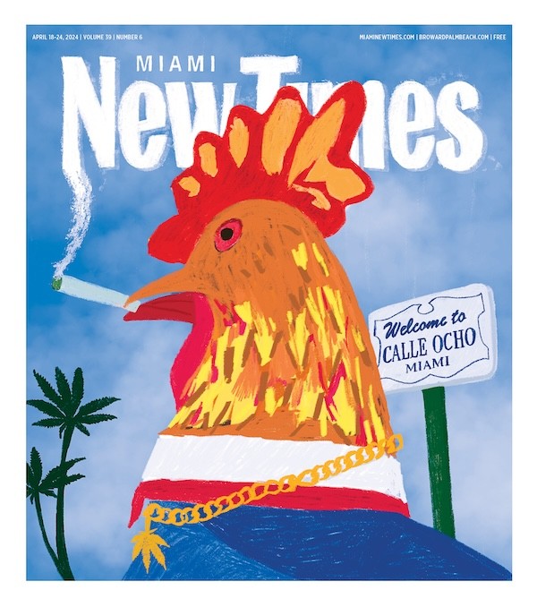
Do Not Sell or Share My Information
